Click to visit the main New York Public Library Homepage
The New York Public Library
Digital Collections
About Digital Collections
Browse
Search only public domain materials
Items
Collections
Divisions
Home
Search
Browse
About
Search only public domain materials
Items
Collections
Divisions
Digital Collections
Using Images
Using Data
Search
Filtered keyword search
Show filters
Hide filters
Show Only Public Domain
topic
Universities & colleges
37
History
31
Ships
25
Boats
17
Public figures
17
More
Less
name
Hill, J. W. (John William), 1812-1879
31
Davis, Alexander Jackson, 1803-1892
22
W. Endicott & Co
22
Bennett, W. J. (William James), 1787-1844
21
Smith Bros. & Co
16
More
Less
collection
I. N. Phelps Stokes Collection of American Historical Prints
673
Print Collection portrait file
17
Samuel Putnam Avery Collection
14
The Eno collection of New York City views
13
William Hogarth: prints
5
More
Less
place
New York (State)
124
New York
97
New York (N.Y.)
94
Massachusetts
36
Boston (Mass.)
29
More
Less
genre
Prints
601
Maps
124
Drawings
100
Portraits
20
Clippings
17
More
Less
publisher
E. Whitefield
9
Smith Brothers & Co
6
Henry I. Megarey
5
Smith, Brothers & Co
5
Atkins & Nightingale
4
More
Less
division
Wallach Division: Print Collection
746
type
still image
648
cartographic
127
text
8
notated music
1
Date Range
to
Looking for this collection?
I. N. Phelps Stokes Collection of American Historical Prints
793 items
746 results found for:
x
map
Filtering on:
x
Division
: Wallach Division: Print Collection
Sort by:
Relevance
Title
Date created
Date digitized
Sequence
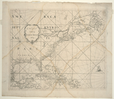
The figurative
map
of Cornelis Hendricks
note:
…"The figurative
map
De Manatus. Op de Noort Riui…
note:
Full-size photograph of Manatus
map
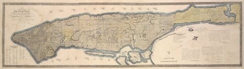
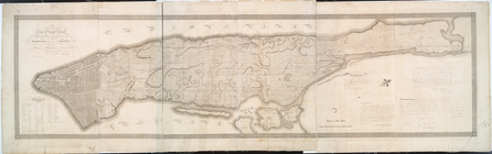
Map
of New York. ; entered 1817
note:
…"This actual
map
Circulus articus oceanus occi…
note:
1883 copy of the 1502
map
in the Estense
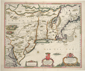
[Early
map
of the Massachusetts Bay region. Inset
This
map
of the city of New York
note:
Reproduction of Eno 73, "This
map
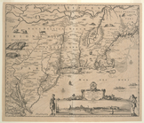
The earliest accurate
map
The
map
note:
Inscription in pencil, l.r.: The
map
.
Recens edita totius Novi Belg…
note:
Stokes Addenda,
Maps
, 1673-
Maps
11
The figurative
map
of Adriaen Block
note:
It is the earliest
map
on which Manhattan
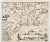
Belgii Novi, Angliae Novae, e…
note:
… the
map
are animals
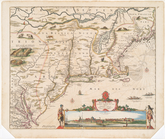
Novi Belgii Novaeque Angliae …
note:
… the
map
are animals
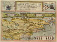
Americae Pars Borealis, Flori…
collection:
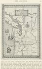
Map
of North America
Map
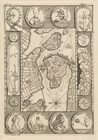
of Stockholm
m
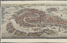
Venetia
topic:
Maps
m
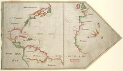
The Virginia Company chart
note:
… that the manuscript
map
m
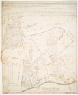
Map
.
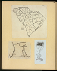
m
Map
of South Carolina.
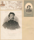
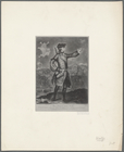
Gen. Blenker [three portraits and a
map
of part
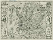
The Kingdom of Scotland. [
Map
.]
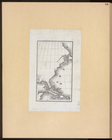
This
map
of the city of New York
… polar expedition,
map
Map
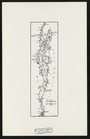
of a part of the Oregon Territory showing
Map
of Lake Champlain from Faden
Map
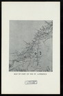
of part of the St. Lawrence.
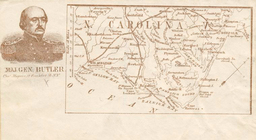
Maj. Gen. Butler [
Map
of N. Carolina
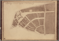
Afbeeldinge van de Stadt Amst…
note:
… and the Manatus
map
of the island
A new plan of ye great town o…
note:
… of the important Bonner
map
Map
of England and Wales
m
Untitled [looking at
map
]
Map
plans of the various encampments
topic:
Maps
, Military
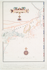
The wreck of the Huron.
Map
of the coast
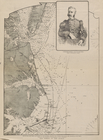
Major General James Wolfe. Co…
note:
…. Sayer,
map
& printseller
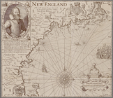
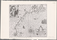
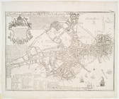
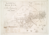
The town of Boston in New Eng…
collection:
The Bonner
map
Map
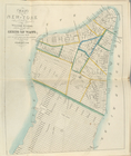
of the city of New York.
The wreck of the Huron.
Map
of the coast
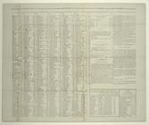
Table of post-offices in the …
note:
Issued with accompanying
map
. See Deak 212.
Americae septentrionalis pars.
note:
Probably the first
map
showing Manhattan
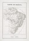
Map
of Brazil.
The
map
…]... Fig.12. Needlework
map
collection:
…. Needlework
map
of Washington
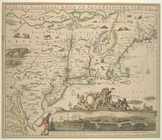
Novi Belgii Novaeque Angliae …
note:
Stokes Addenda,
Maps
, C.1651-55-
Maps
-5
No. 1 A
map
of the lands belonging
Novi Belgii Novaeque Angliae …
collection:
The Danckers
map
Totius Neobelgii Nova et accu…
collection:
The Restitutio-Carolus Allard
map
m
…
map
, a large drum
Map
of the country thirty miles round
Untitled
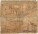
Map
of the United States, flanked
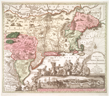
A new
map
of the English plantations
note:
Stokes Addenda,
Maps
, C.1675-80-
Maps
-15
A new and correct
map
of the United
1
2
3
Previous
Next
1
2
3
Previous
Next