Click to visit the main New York Public Library Homepage
The New York Public Library
Digital Collections
About Digital Collections
Browse
Search only public domain materials
Items
Collections
Divisions
Home
Search
Browse
About
Search only public domain materials
Items
Collections
Divisions
Digital Collections
Using Images
Using Data
Search
Filtered search
Show filters
Hide filters
Show Only Public Domain
topic
x
Administrative and political divisions
Landowners
7
Real property
6
Railroads
4
Cities and towns
1
More
Less
name
x
Walling, Henry Francis, 1825-1888
Sampson, Davenport & Co
3
Gray, O. W. (Ormando Wyllis), 1829-1912
2
H.F. Walling's Map Establishment
2
Baker & Tilden
1
More
Less
collection
Maps of North America
18
Maps of New York City and State
1
place
Massachusetts
7
Rhode Island
4
Connecticut
3
Hampden County (Mass.)
3
Vermont
3
More
Less
genre
x
Maps
Cadastral maps
5
publisher
H.F. Walling
3
Sampson, Davenport & Co
3
Baker & Tilden
1
C.B. Peckham
1
E.P. Dutton & Company
1
More
Less
division
Map Division
19
type
cartographic
19
still image
1
Date Range
to
19 results found
Filtering on:
x
Genre
: Maps
x
Name
: Walling, Henry Francis, 1825-1888
x
Topic
: Administrative and political divisions
Sort by:
Title
Date created
Date digitized
Sequence
Map of New England, with adja…
Map of the city of Milwaukee,…
Hampshire and Hampden countie…
Map of Massachusetts: to acco…
Franklin County
m
Topographical map of the Coun…
Map of Bennington County, Ver…
m
Map of Essex County, New Jers…
m
Topographical map of the stat…
m
Map of the State of Rhode Isl…
Map of the village of Taunton…
Map of the town of Tiverton, …
Map of Boston and the country…
Map of New England with adjac…
Map of Berkshire County, Mass…
m
Map of Hampden County, Massac…
m
Map of New London County, Con…
Map of Massachusetts: compris…
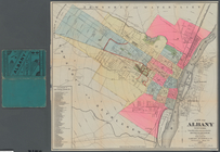
City of Albany, New York: fro…
End of results
|
Top