Click to visit the main New York Public Library Homepage
The New York Public Library
Digital Collections
About Digital Collections
Browse
Search only public domain materials
Items
Collections
Divisions
Home
Search
Browse
About
Search only public domain materials
Items
Collections
Divisions
Digital Collections
Using Images
Using Data
Search
Filtered keyword search
Show filters
Hide filters
Show Only Public Domain
topic
x
Rivers
Canals
11
Ferries
10
Fire alarms
10
Railroads
10
More
Less
name
A. Brown & Co
8
McCloskey, Henry
5
Bishop, William G
2
Adams, J. W. (Julius Walker), 1812-1899
1
American Photo-Lithographic Company
1
More
Less
collection
Maps of New York City and State
12
place
x
Brooklyn (New York, N.Y.)
New York
12
New York (State)
12
Brooklyn
5
genre
x
Maps
publisher
A. Brown & Co
5
A. Brown
3
Gaylord Watson
1
J.H. Colton & Co
1
J.H. Higginson
1
More
Less
division
Map Division
12
type
cartographic
12
Date Range
to
12 results found for:
x
east river
Filtering on:
x
Genre
: Maps
x
Place
: Brooklyn (New York, N.Y.)
x
Topic
: Rivers
Sort by:
Relevance
Title
Date created
Date digitized
Sequence
m
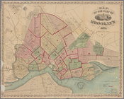
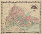
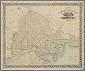
Map of the city of Brooklyn
abstract:
… Street and
east
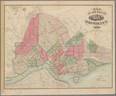
Map of the city of Brooklyn
abstract:
… Street and
east
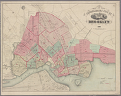
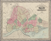
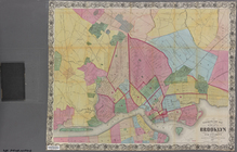
Map of the consolidated city …
abstract:
… Street and
east
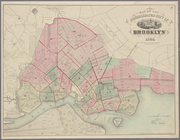
Map of the consolidated city …
abstract:
… Street and
east
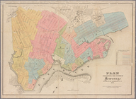
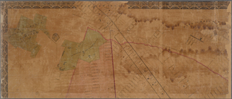
Plan exhibiting the system of…
abstract:
… and
east
to the Cemetery
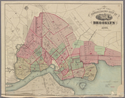
Map of the consolidated city …
abstract:
… Street and
east
Map of the consolidated city …
abstract:
… Street and
east
Map of the consolidated city …
abstract:
… Street and
east
m
Higginson's plan of the city …
topic:
Rivers
Map of the consolidated city …
abstract:
… Street and
east
m
Watson's new map of the city …
abstract:
… to Green Point, and
east
m
Map of the City of Brooklyn a…
note:
… Street and
east
End of results
|
Top