Click to visit the main New York Public Library Homepage
The New York Public Library
Digital Collections
About Digital Collections
Browse
Search only public domain materials
Items
Collections
Divisions
Home
Search
Browse
About
Search only public domain materials
Items
Collections
Divisions
Digital Collections
Using Images
Using Data
Search
Filtered keyword search
Show filters
Hide filters
Show Only Public Domain
topic
Nautical charts
10
Administrative and political divisions
8
Railroads
7
History
6
Landowners
6
More
Less
name
United States Coast Survey
9
Bache, A. D. (Alexander Dallas), 1806-1867
8
Anville, Jean Baptiste Bourguignon d', 1697-1782
6
Gerdes, F. H
6
Haye, G. de la
6
More
Less
collection
Maps of North America
64
Lawrence H. Slaughter Collection of English maps, charts, globes, books and atlases
8
Atlases, gazetteers, guidebooks and other books
1
place
x
Louisiana
New Orleans
13
New Orleans (La.)
13
United States
11
North America
8
More
Less
genre
x
Maps
Nautical charts
10
Cadastral maps
6
Topographic maps
5
land surveys
4
More
Less
publisher
U.S. Coast Survey Office
5
Advisory Board on Drainage
4
U.S. Coast Survey
4
publisher not identified
4
Chez l'auteur, aux Galeries du Louvre
3
More
Less
division
Map Division
73
type
cartographic
73
text
1
Date Range
to
73 results found for:
x
Louisiana
Filtering on:
x
Genre
: Maps
x
Place
: Louisiana
Sort by:
Relevance
Title
Date created
Date digitized
Sequence
… of
Louisiana
Johnson's Arkansas, Mississippi, and
Louisiana
State of
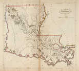
Louisiana
…
m
Post route map of the state of
Louisiana
…
Map of
Louisiana
abstract:
… depicting
Louisiana
justice
… of
Louisiana
…
Map of
Louisiana
…
…,
Louisiana
…
Map of the Parish of Carroll,
Louisiana
…
Map of
Louisiana
…
Map of
Louisiana
…
m
… of
Louisiana
…
…,
Louisiana
…
Map of the South Western district
Louisiana
abstract:
Shows southwest
Louisiana
between the Sabine
Sketch of the Pontchartrain H…
collection:
…,
Louisiana
m
… of
Louisiana
…
Map of the Parish of Winn,
Louisiana
…
Map of the State of
Louisiana
…
… & Calcasieu River,
Louisiana
…
Map of New Covington, in St. …
collection:
Louisiana
Map of
Louisiana
…
… and settlements of
Louisiana
Louisiana
Plate IV: Map of New Orleans…
collection:
Louisiana
m
…,
Louisiana
Plate I: General map of the P…
collection:
Louisiana
Plate II: Contour map of New …
collection:
Louisiana
… to Barataria Bay,
Louisiana
…
Plate III: Map of New Orleans…
collection:
Louisiana
m
The World's Industrial and Co…
abstract:
… of
Louisiana
and Texas -- Plan
…,
Louisiana
…
Military map of part of
Louisiana
…
Louisiana
, as formerly claimed by France …
Plan of the city of New Orlea…
collection:
Louisiana
Map of the South West
abstract:
…),
Louisiana
, Arkansas
Map of Mississippi,
Louisiana
& Arkansas
abstract:
…,
Louisiana
, Arkansas.
Passe A Loutre, Mississippi Delta,
Louisiana
…
The
Louisiana
State
Carte de la Louisiane
collection:
Louisiana
New Orleans : map of the revo…
collection:
Louisiana
Map of New Orleans and Jeffer…
collection:
Louisiana
Canada et Louisiane
note:
Includes inset maps of extensions of
Louisiana
m
A map of the state of
Louisiana
with part
… of the province of
Louisiana
m
…, and the coast of
Louisiana
from
abstract:
Coastal chart from western edge of
Louisiana
Carte reduite des costes de l…
collection:
Louisiana
Preliminary chart of the Rigolets,
Louisiana
…
Preliminary Chart of Atchafalaya Bay,
Louisiana
…
m
Norman's plan of New Orleans …
note:
… District of
Louisiana
."…
Map of the district through w…
collection:
Louisiana