Click to visit the main New York Public Library Homepage
The New York Public Library
Digital Collections
About Digital Collections
Browse
Search only public domain materials
Items
Collections
Divisions
Home
Search
Browse
About
Search only public domain materials
Items
Collections
Divisions
Digital Collections
Using Images
Using Data
Search
Filtered keyword search
Show filters
Hide filters
Show Only Public Domain
topic
Real property
252
Fire insurance
50
Cities & towns
47
Administrative and political divisions
41
Nautical charts
34
More
Less
name
Ullitz, Hugo
95
E.B. Hyde & Co
92
E. Belcher Hyde Map Company
72
Sanborn Map Company
48
G.W. Bromley & Co
33
More
Less
collection
Atlases of New York City
235
Maps of North America
210
Maps of New York City and State
103
Atlases of the United States
43
Bancker plans
32
More
Less
place
New York (State)
306
New York
182
Brooklyn (New York, N.Y.)
110
Maps
88
New York (N.Y.)
84
More
Less
genre
x
Maps
Atlases
42
Surveys
34
land surveys
29
Cadastral maps
22
More
Less
publisher
E. Belcher Hyde
76
Sanborn Map Company
49
G.W. Bromley & Co
29
publisher not identified
28
Lith. by Korff Brothers
22
More
Less
division
Map Division
630
Manuscripts and Archives Division
35
Wallach Division: Print Collection
6
Schomburg Jean Blackwell Hutson Research and Reference Division
4
Rare Book Division
3
More
Less
type
x
cartographic
text
14
still image
7
Date Range
to
683 results found for:
x
30
Filtering on:
x
Genre
: Maps
x
Type
: cartographic
Sort by:
Relevance
Title
Date created
Date digitized
Sequence
Karta Rossii I. Massy 1633g. Str.
30
…, Double Page Plate No.
30
; Part of Ward
30
Health Department physicians …
abstract:
… for the year ending June
30
Balloon view of Narragansett …
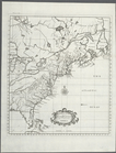
A mapp of Virginia
Plan of the seat of war : [Vi…
parent:
6bfb6e50-6980-0135-
30
d3-318effefdb57
… ending June
30
, 1894
note:
… June
30
, 1884
… ending June
30
, 1894
note:
… June
30
, 1894
m
Stone Street
note:
Block 28, 29, or
30
.
m
Little Dock or Water Street
note:
Block
30
or 32.
Map of Swanzey, 1890: [New Ha…
Plate
30
: [Bounded by New York Bay
parent:
b6999d
30
-c604-012f-643f-58d385a7bc34
Map of Oregon, Washington, Id…
m
Lots on Coenties Slip
note:
Blocks
30
or 32.
m
Calculation of part of lot
30
of Warren
m
Water Street
note:
Block 7 or
30
.
m
Queen Street, Water Street, F…
note:
Blocks
30
or 31.
Coney Island: Part of Section…
collection:
Plate
30
Plate
30
: Bounded by Seneca Avenue, Covert
Map of the city of Washington…
… & 19. Ward
30
. City
…; Part of Ward
30
…; Part of Ward
30
…; Part of Ward
30
…; Part of Ward
30
…; Part of Ward
30
…; Part of Ward
30
…; Part of Ward
30
…; Part of Ward
30
…; Part of Ward
30
…; Part of Ward
30
…; Part of Ward
30
…; Part of Ward
30
…; Part of Ward
30
…; Part of Ward
30
…; Part of Ward
30
…; Part of Ward
30
…; Part of Ward
30
…; Part of Ward
30
…; Part of Ward
30
…; Part of Ward
30
…; Part of Ward
30
…; Part of Ward
30
…; Part of Ward
30
…; Part of Ward
30
Map of the city of Washington…
Map of the city of Washington…
A map of the British-plantati…
note:
…. [Thomas] Salmon, v.
30
…; Part of Ward
30
…; Part of Ward
30
1
2
3
Previous
Next
1
2
3
Previous
Next