Click to visit the main New York Public Library Homepage
The New York Public Library
Digital Collections
About Digital Collections
Browse
Search only public domain materials
Items
Collections
Divisions
Home
Search
Browse
About
Search only public domain materials
Items
Collections
Divisions
Digital Collections
Using Images
Using Data
Search
Filtered keyword search
Show filters
Hide filters
Show Only Public Domain
topic
Bridges
1
Harbors
1
Irrigation canals & flumes
1
Landowners
1
Maps
1
More
Less
name
Ackerman, James, 1815 or 1816-1864
1
Alden, James, 1810-1877
1
Boggs, Benj. R. (Benjamin Randolph)
1
Centennial Exhibition (1876 : Philadelphia, Pa.)
1
Davis, Theodore R
1
More
Less
collection
Maps of North America
3
An essay on colonization, particularly applied to the western coast of Africa, with some free thoughts on cultivation and commerce; also brief descriptions of the colonies already formed, or attempted, in Africa, including those of Sierra Leona and Bulama. By C.B. Wadstrom. In two parts; illustrated with a nautical map (from lat. 5⁰ 30' to lat. 14⁰ N.) and other plates
1
Description de l'Égypte: ou, Recueil des observations et des recherches qui ont été faites en Égypte pendant l'expédition de l'armée française
1
I. N. Phelps Stokes Collection of American Historical Prints
1
Maps of New York City and State
1
More
Less
place
Philadelphia (Pa.)
2
Bronx (New York, N.Y.)
1
California
1
Ebenezer (Ga.)
1
Egypt
1
More
Less
genre
x
Maps
Aerial views
2
Illustrations
2
Prints
2
Clippings
1
More
Less
publisher
Benj. R. Boggs
1
Harper & Brothers
1
Impr. impériale
1
Printed for the author by Darton and Harvey
1
Topographical Bureau
1
More
Less
division
Map Division
4
General Research Division
1
Rare Book Division
1
Schomburg Manuscripts, Archives and Rare Books Division
1
Wallach Division: Print Collection
1
type
x
still image
cartographic
7
text
1
Date Range
to
8 results found for:
x
30
Filtering on:
x
Genre
: Maps
x
Type
: still image
Sort by:
Relevance
Title
Date created
Date digitized
Sequence
m
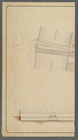
Plan and profile showing the …
note:
…"Profile horizontal & vertical scale =
30
feet
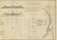
A general sketch of the Harbo…
collection:
… map (from lat. 5⁰
30
Reconnaissance of the S.E. en…
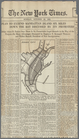
m
The Centennial--balloon view …
abstract:
…, September
30
, 1876. Title
A map of Philadelphia and par…
Plan to extend Manhattan Isla…
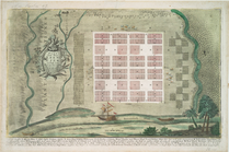
Plan von Neu Eben-ezer
…; 29.
30
. Profils de la