Click to visit the main New York Public Library Homepage
The New York Public Library
Digital Collections
About Digital Collections
Browse
Search only public domain materials
Items
Collections
Divisions
Home
Search
Browse
About
Search only public domain materials
Items
Collections
Divisions
Digital Collections
Using Images
Using Data
Search
Filtered search
Show filters
Hide filters
Show Only Public Domain
topic
City planning
944
Social conditions
942
History
130
Historic sites
50
Real property
28
More
Less
name
M.I.T. Press
942
New York (N.Y.). City Planning Commission
942
Montanus, Arnoldus, 1625?-1683
97
Ogilby, John, 1600-1676
97
Nicolaus Germanus, active 15th century
27
More
Less
collection
Atlases of New York City
946
Lawrence H. Slaughter Collection of English maps, charts, globes, books and atlases
106
Maps of North America
93
Cigarette cards
51
Wallach Division Picture Collection
29
More
Less
place
New York (State)
966
New York (N.Y.)
960
New York
950
America
100
West Indies, British
97
More
Less
genre
x
Maps
Illustrations
71
Prints
66
Advertising cards
59
Advertisements
54
More
Less
publisher
MIT Press
942
Printed by the author, and are to be had at his house
97
Printed for T. Astley
10
Impr. impériale
8
War Dept., U.S. Pacific Rail Road Explorations & Surveys
8
More
Less
division
Map Division
1186
George Arents Collection
51
Rare Book Division
44
Manuscripts and Archives Division
38
Wallach Division: Picture Collection
30
More
Less
type
x
still image
cartographic
316
text
136
Date Range
to
1,430 results found
Filtering on:
x
Genre
: Maps
x
Type
: still image
Sort by:
Title
Date created
Date digitized
Sequence
Congo
m
Knickerbocker Village
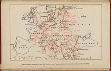
Map of Europe, showing in Red…
m
Il dirigibile "Norge" alla sc…
m
Drawing of campsite on the Li…
A Map or North East and North…
Kaert von Groen-Land, [fold o…
Map of Great Fire, 1776
m
Visitor's Map of Florence
m
Map of Rome
m
Italian State Tourist Departm…
Geroicheskiĭ pokhod
Most extraordinary [camera sh…
m
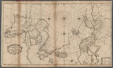
Greenland, [Map]
Præfecturæ Paranambucæ par bo…
The Narrows tunnel : chart of…
Ethnological Chart of the Wor…
Chart of part of the Coast of…
m
Primorskai︠a︡ S.-Peterburgo-S…
m
Osnovnyi︠a︡ soobrazhenīi︠a︡ k…
m
Petrovskai︠a︡ zhel. doroga : …
m
Prilozhenīe 2-oe kʺ proektu s…
Sevilla
Vilna Litvaniae
Map of the New World
m
Cosmographey oder beschreibun…
m
New York City subway map with…
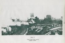
View from the north (figure 9)
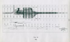
Map. Manhattan's Railroad ent…
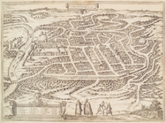
Plan de la ville Tartare de P…
Map of the Gogebic Iron Range…
Plan of the city of Philadelp…
m
Map of property at Fairmount…
Egtypon Isaei. Ichonographia …
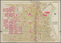
Bounded by Snediker Avenue, L…
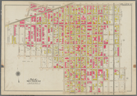
Bounded by Park Place, East N…
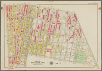
Bounded by Saratoga Avenue, E…
m
With the 114th in the ETO: A …
m
Memoranda
New and improved map of the c…
Bird's eye view of Philadelph…
m
Topographical map of the coun…
A new and correct map of Conn…
m
Map of Clinton Co., New York:…
Grand Rapids, Michigan 1868
Perspective map of the city o…
m
Nelson, R.H
A map of Philadelphia and par…
m
The Centennial--balloon view …
Bird's eye view of the city o…
1
2
3
4
5
6
Previous
Next
1
2
3
4
5
6
Previous
Next