Click to visit the main New York Public Library Homepage
The New York Public Library
Digital Collections
About Digital Collections
Browse
Search only public domain materials
Items
Collections
Divisions
Home
Search
Browse
About
Search only public domain materials
Items
Collections
Divisions
Digital Collections
Using Images
Using Data
Search
Filtered keyword search
Show filters
Hide filters
Show Only Public Domain
topic
Real property
690
Fire insurance
367
Cities & towns
364
Maps
73
City planning
38
More
Less
name
Sanborn Map Company
366
G.W. Bromley & Co
187
Ullitz, Hugo
102
E. Belcher Hyde Map Company
90
E.B. Hyde & Co
68
More
Less
collection
Atlases of New York City
746
Maps of North America
108
Maps of New York City and State
80
Bancker plans
64
Atlases of the United States
55
More
Less
place
New York (State)
772
New York
301
Bronx (New York, N.Y.)
187
New York (N.Y.)
162
Brooklyn (New York, N.Y.)
114
More
Less
genre
x
Maps
Surveys
65
land surveys
60
Atlases
53
Cadastral maps
21
More
Less
publisher
Sanborn Map Company
366
G.W. Bromley & Co
177
E. Belcher Hyde
67
MIT Press
38
Hyde & Co
31
More
Less
division
Map Division
1047
Manuscripts and Archives Division
68
General Research Division
10
Wallach Division: Print Collection
9
Rare Book Division
4
More
Less
type
cartographic
1106
still image
49
text
19
Date Range
to
1,146 results found for:
x
11
Filtering on:
x
Genre
: Maps
Sort by:
Relevance
Title
Date created
Date digitized
Sequence
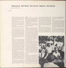
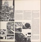
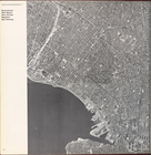
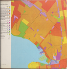
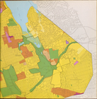
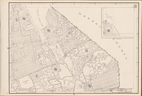
Brooklyn community planning District
11
Bensonhurst, Bath Beach, New …
collection:
District
11
Bensonhurst, Bath Beach, New …
collection:
District
11
Bensonhurst, Bath Beach, New …
collection:
District
11
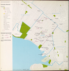
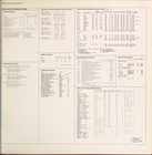
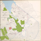
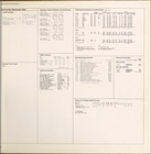
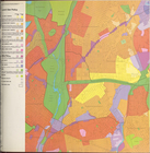
Land use policy
collection:
District
11
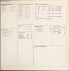
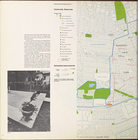
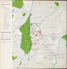
Community resources
collection:
District
11
Community resources data
collection:
District
11
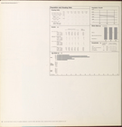
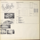
Scheduled new construction
collection:
District
11
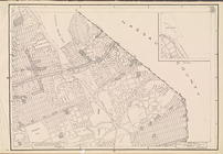
Manhattan community planning District
11
. East
East Harlem, Randall's Island…
collection:
District
11
East Harlem, Randall's Island…
collection:
District
11
East Harlem, Randall's Island…
collection:
District
11
East Harlem, Randall's Island…
collection:
District
11
East Harlem, Randall's Island…
collection:
District
11
Land use policy
collection:
District
11
Community resources
collection:
District
11
Community resources data
collection:
District
11
Scheduled new construction
collection:
District
11
Queens community planning District
11
Bayside, Auburndale, Oakland …
collection:
District
11
Bayside, Auburndale, Oakland …
collection:
District
11
Bayside, Auburndale, Oakland …
collection:
District
11
Bayside, Auburndale, Oakland …
collection:
District
11
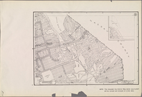
Land use policy
collection:
District
11
Land use policy (cont.)
collection:
District
11
Community resources
collection:
District
11
Community resources (cont.)
collection:
District
11
Bayside, Auburndale, Oakland …
collection:
District
11
Community resources data
collection:
District
11
Scheduled new construction
collection:
District
11
Bronx community planning District
11
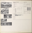
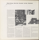
Pelham Parkway, Morris Park, …
collection:
District
11
Pelham Parkway, Morris Park, …
collection:
District
11
Pelham Parkway, Morris Park, …
collection:
District
11
Land use policy
collection:
District
11
Community resources
collection:
District
11
Community resources data
collection:
District
11
Scheduled new construction
collection:
District
11
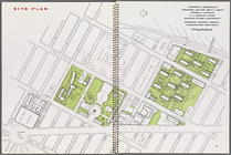
Site plan, [Page 16 and 17]
collection:
Series
11
. Committee on Slum Clearance
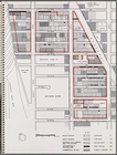
Map illustrating structures n…
collection:
Series
11
. Committee on Slum Clearance
Plate
11
, Part of Section 1
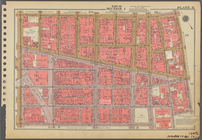
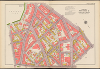
Height Zoning Map Section No.
11
Use Zoning Map Section No.
11
Use Zoning Map Section No.
11
add
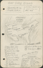
On the Road: map, itinerary, …
m
Hagstrom's map of Queens N.Y.…
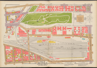
Double Page Plate No.
11
, Part
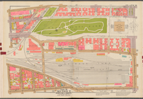
Double Page Plate No.
11
, Part
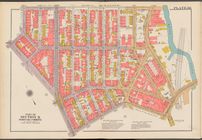
… of Section
11
, Borough
… of Section
11
, Borough
1
2
3
4
5
Previous
Next
1
2
3
4
5
Previous
Next