Click to visit the main New York Public Library Homepage
The New York Public Library
Digital Collections
About Digital Collections
Browse
Search only public domain materials
Items
Collections
Divisions
Home
Search
Browse
About
Search only public domain materials
Items
Collections
Divisions
Digital Collections
Using Images
Using Data
Search
Filtered keyword search
Show filters
Hide filters
Show Only Public Domain
topic
Real property
252
Fire insurance
50
Cities & towns
47
Administrative and political divisions
41
Nautical charts
34
More
Less
name
Ullitz, Hugo
95
E.B. Hyde & Co
92
E. Belcher Hyde Map Company
72
Sanborn Map Company
48
G.W. Bromley & Co
33
More
Less
collection
Atlases of New York City
235
Maps of North America
210
Maps of New York City and State
103
Atlases of the United States
43
Bancker plans
32
More
Less
place
New York (State)
306
New York
182
Brooklyn (New York, N.Y.)
110
Maps
88
New York (N.Y.)
84
More
Less
genre
x
Maps
Atlases
42
Surveys
34
land surveys
29
Cadastral maps
22
More
Less
publisher
E. Belcher Hyde
76
Sanborn Map Company
49
G.W. Bromley & Co
29
publisher not identified
28
Lith. by Korff Brothers
22
More
Less
division
Map Division
630
Manuscripts and Archives Division
35
Wallach Division: Print Collection
6
Schomburg Jean Blackwell Hutson Research and Reference Division
4
General Research Division
3
More
Less
type
cartographic
683
text
15
still image
8
Date Range
to
684 results found for:
x
30
Filtering on:
x
Genre
: Maps
Sort by:
Relevance
Title
Date created
Date digitized
Sequence
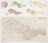
Czechoslovakia
Plate
30
, Part of Section 2
Height Zoning Map Section No.
30
parent:
30593990-bc6a-0132-4f
30
-58d385a7bbd0
Use Zoning Map Section No.
30
parent:
30593990-bc6a-0132-4f
30
-58d385a7bbd0
m
Hagstrom's map of Queens N.Y.…
note:
Scale approximately 1:
30
,000 (W 73°56ʹ49ʺ--W
Double Page Plate No.
30
, Part
Double Page Plate No.
30
, Part
parent:
789b9c
30
-3071-0132-d134-58d385a7b928
Double Page Plate No.
30
, Part
Double Page Plate No.
30
, Part
Use District Map Section No.
30
parent:
30593990-bc6a-0132-4f
30
-58d385a7bbd0
Area District Map Section No.
30
parent:
30593990-bc6a-0132-4f
30
-58d385a7bbd0
Height District Map Section No.
30
parent:
f9925be0-c5fa-012f-fc
30
-58d385a7bc34
Plate
30
, Part of Section 2
Plate
30
, Part of Section 2
Height District Map Section No.
30
parent:
30593990-bc6a-0132-4f
30
-58d385a7bbd0
Area District Map Section No.
30
parent:
30593990-bc6a-0132-4f
30
-58d385a7bbd0
Use District Map Section No.
30
parent:
30593990-bc6a-0132-4f
30
-58d385a7bbd0
Plate
30
Height District Map Section No.
30
parent:
30593990-bc6a-0132-4f
30
-58d385a7bbd0
Use District Map Section No.
30
parent:
30593990-bc6a-0132-4f
30
-58d385a7bbd0
Area District Map Section No.
30
parent:
30593990-bc6a-0132-4f
30
-58d385a7bbd0
Plate
30
Queens V. 8, Plate No.
30
[Map bounded
parent:
30593990-bc6a-0132-4f
30
-58d385a7bbd0
Plan to extend Manhattan Isla…
Plate
30
, Part of Section 5: [Bounded by E
Plate
30
, Part of Section 10, Borough
m
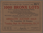
Follow the Lead of the "Leade…
collection:
… to liquidate
30
estates.
Jersey City, V. 1, Double Page Plate No.
30
Queens, Vol. 1A, Double Page Plate No.
30
Bronx, V. 18, Plate No.
30
[Map bounded
parent:
30593990-bc6a-0132-4f
30
-58d385a7bbd0
Plate
30
, Part of Ward 2 [Map bound
Plate
30
, Part of Ward 5 [Map bound
Staten Island, V. 1, Plate No.
30
[Map
Bounded by E. 14th Street, Se…
Area District Map Section No.
30
parent:
30593990-bc6a-0132-4f
30
-58d385a7bbd0
Height District Map Section No.
30
parent:
30593990-bc6a-0132-4f
30
-58d385a7bbd0
Use District Map Section No.
30
parent:
30593990-bc6a-0132-4f
30
-58d385a7bbd0
… Plate No.
30
; Part
…; Part of Wards 8 &
30
… &
30
, Section 3; [Map
… Plate No.
30
; Part
…. Wards 29 &
30
. Published
…; Part of Wards 29,
30
…; Part of Wards 29 &
30
…; Part of Wards 29,
30
…; Part of Ward
30
…; Part of Ward
30
…; Part of Ward
30
…; Part of Ward
30
…; Part of Ward
30
1
2
3
Previous
Next
1
2
3
Previous
Next