Click to visit the main New York Public Library Homepage
The New York Public Library
Digital Collections
About Digital Collections
Browse
Search only public domain materials
Items
Collections
Divisions
Home
Search
Browse
About
Search only public domain materials
Items
Collections
Divisions
Digital Collections
Using Images
Using Data
Search
Filtered keyword search
Show filters
Hide filters
Show Only Public Domain
topic
Real property
20
Nautical charts
10
History
9
Railroads
9
Administrative and political divisions
8
More
Less
name
E.B. Hyde & Co
9
Ullitz, Hugo
9
United States Coast Survey
9
Bache, A. D. (Alexander Dallas), 1806-1867
8
E. Belcher Hyde Map Company
8
More
Less
collection
Maps of North America
91
Atlases of New York City
16
Lawrence H. Slaughter Collection of English maps, charts, globes, books and atlases
13
Atlases, gazetteers, guidebooks and other books
3
Atlases of the United States
1
More
Less
place
Louisiana
73
United States
21
North America
18
New York (State)
15
New Orleans
14
More
Less
genre
x
Maps
Nautical charts
10
Cadastral maps
6
Topographic maps
6
land surveys
4
More
Less
publisher
E. Belcher Hyde
8
publisher not identified
6
U.S. Coast Survey Office
5
Advisory Board on Drainage
4
Sanborn Map Company
4
More
Less
division
Map Division
124
Manuscripts and Archives Division
1
Wallach Division: Print Collection
1
type
cartographic
126
still image
1
text
1
Date Range
to
126 results found for:
x
Louisiana
Filtering on:
x
Genre
: Maps
Sort by:
Relevance
Title
Date created
Date digitized
Sequence
m
…,
Louisiana
….,
Louisiana
Ave., Stanley Ave
…., Border Ave.,
Louisiana
….,
Louisiana
Ave., Stanley Ave
…., Border Ave.,
Louisiana
… by Farragut Rd.,
Louisiana
Ave
… by Avenue K,
Louisiana
Ave
… by Avenue N,
Louisiana
Ave
… Avenue,
Louisiana
Avenue
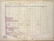
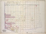
Bounded by Stanley Ave., Mill…
collection:
…. & (Fresh Creek)
Louisiana
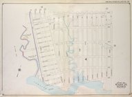
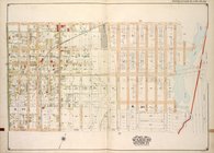
Brooklyn, Vol. 4, Double Page…
abstract:
….,
Louisiana
Ave.
…,
Louisiana
Avenue, Williams
Eighth l. h. district
Map of the State of
Louisiana
…
Plate IV: Map of New Orleans…
collection:
Louisiana
Plate I: General map of the P…
collection:
Louisiana
Plate II: Contour map of New …
collection:
Louisiana
Plate III: Map of New Orleans…
collection:
Louisiana
…,
Louisiana
St., Lake Erie]
Map of New Covington, in St. …
collection:
Louisiana
… Avenue,
Louisiana
Avenue
…, with adjacent parts of
Louisiana
m
The World's Industrial and Co…
abstract:
… of
Louisiana
and Texas -- Plan
….,
Louisiana
Ave., Foster Ave
….,
Louisiana
Ave.]
….,
Louisiana
Ave.]
….,
Louisiana
Ave.]
… and settlements of
Louisiana
Map of the South West
abstract:
…),
Louisiana
, Arkansas
m
Post route map of the states …
m
…, with adjacent parts of
Louisiana
m
Post route map of the state o…
m
Post route map of the state of
Louisiana
…
State of
Louisiana
…
m
… of
Louisiana
…
…, Arkansas and
Louisiana
…
Plan of the city of New Orlea…
collection:
Louisiana
New Orleans : map of the revo…
collection:
Louisiana
… of
Louisiana
…
The
Louisiana
State
m
… of
Louisiana
…
… of
Louisiana
Map of New Orleans and Jeffer…
collection:
Louisiana
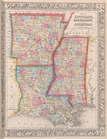
Johnson's Arkansas, Mississippi, and
Louisiana
Map no. 16, Battlefield of Fo…
Map no. 12, Port Hudson and v…
Profiles of enemy's works, Po…
Map of
Louisiana
, Mississippi, and Arkansas.
Military map of part of
Louisiana
…
Perrine's new topographical w…
note:
…, Mississippi,
Louisiana