Click to visit the main New York Public Library Homepage
The New York Public Library
Digital Collections
About Digital Collections
Browse
Search only public domain materials
Items
Collections
Divisions
Home
Search
Browse
About
Search only public domain materials
Items
Collections
Divisions
Digital Collections
Using Images
Using Data
Search
Filtered keyword search
Show filters
Hide filters
Show Only Public Domain
topic
Real property
20
Nautical charts
10
History
9
Railroads
9
Administrative and political divisions
8
More
Less
name
E.B. Hyde & Co
9
Ullitz, Hugo
9
United States Coast Survey
9
Bache, A. D. (Alexander Dallas), 1806-1867
8
E. Belcher Hyde Map Company
8
More
Less
collection
Maps of North America
91
Atlases of New York City
16
Lawrence H. Slaughter Collection of English maps, charts, globes, books and atlases
13
Atlases, gazetteers, guidebooks and other books
3
Atlases of the United States
1
More
Less
place
Louisiana
73
United States
21
North America
18
New York (State)
15
New Orleans
14
More
Less
genre
x
Maps
Nautical charts
10
Cadastral maps
6
Topographic maps
6
land surveys
4
More
Less
publisher
E. Belcher Hyde
8
publisher not identified
6
U.S. Coast Survey Office
5
Advisory Board on Drainage
4
Sanborn Map Company
4
More
Less
division
Map Division
124
Manuscripts and Archives Division
1
Wallach Division: Print Collection
1
type
cartographic
126
still image
1
text
1
Date Range
to
126 results found for:
x
Louisiana
Filtering on:
x
Genre
: Maps
Sort by:
Relevance
Title
Date created
Date digitized
Sequence
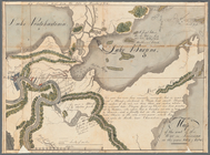
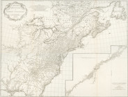
Map of the seat of the War in
Louisiana
….,
Louisiana
Ave., Foster Ave
….,
Louisiana
Ave.]
….,
Louisiana
Ave.]
….,
Louisiana
Ave.]
m
… names of
Louisiana
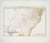
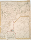
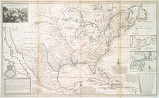
A new map of ye north parts o…
… names of
Louisiana
Canada, Louisiane et terres a…
Canada, Louisiane et terres a…
Canada, Louisiane et terres a…
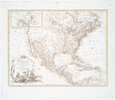
A map of Mexico,
Louisiana
, and the Missouri
Carte de la Louisiane, Maryla…
Carte de la Louisiane, Maryla…
Carte de la Louisiane et pais…
Carte de la Louisiane et du c…
Carte de la Louisiane et du c…
Carte du Canada et de la Loui…
Canada, Louisiane et terres a…
Canada et Louisiane
note:
Includes inset maps of extensions of
Louisiana
Theatre de la guerre en Améri…
note:
… segments of
Louisiana
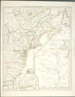
A new map of ye north parts o…
… names of
Louisiana
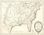
L'Amérique septentrionale
abstract:
… of
Louisiana
. Includes inset
Carte de la Louisiane et du c…
Eighth l. h. district
Carte de la Louisiane et des …
Map of Spanish
Louisiana
and the American
note:
… of
Louisiana
... (The Gentleman
Map of Spanish
Louisiana
and the American
note:
… of
Louisiana
... (The Gentleman
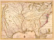
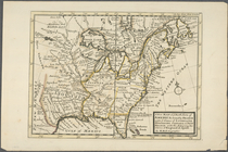
United States of America, sou…
note:
Covers Virginia to Florida, west to
Louisiana
.
…
Louisiana
…
Louisiana
…,
Louisiana
, and all
A new and general map of the …
Part of the boundary between …
note:
…,
Louisiana
, August 10, 1841
Part of the boundary between …
note:
…,
Louisiana
, August 10, 1841
G. Woolworth Colton's map of …
note:
… of southeastern
Louisiana
.
Map illustrating the plan of …
abstract:
… and
Louisiana
. Also shows
Map of the country between th…
note:
… of
Louisiana
, in the year 1852
Perrine's new topographical w…
note:
…, Mississippi,
Louisiana
m
Colton's map of the southern …
Map of Mississippi,
Louisiana
& Arkansas
abstract:
…,
Louisiana
, Arkansas.
…, Arkansas and
Louisiana
…
Map of the South West
abstract:
…),
Louisiana
, Arkansas
m
Post route map of the states …
Plan of the city and suburbs …
collection:
Louisiana
Plate I: General map of the P…
collection:
Louisiana
Plate II: Contour map of New …
collection:
Louisiana
Plate III: Map of New Orleans…
collection:
Louisiana
Plate IV: Map of New Orleans…
collection:
Louisiana