Click to visit the main New York Public Library Homepage
The New York Public Library
Digital Collections
About Digital Collections
Browse
Search only public domain materials
Items
Collections
Divisions
Home
Search
Browse
About
Search only public domain materials
Items
Collections
Divisions
Digital Collections
Using Images
Using Data
Search
Filtered keyword search
Show filters
Hide filters
Show Only Public Domain
topic
Administrative and political divisions
6
Railroads
4
Buildings
3
Parks
3
Streets
3
More
Less
name
Mitchell, S. Augustus (Samuel Augustus), 1792-1868
5
Mitchell, S. Augustus, Jr. (Samuel Augustus)
3
Gamble, W. H. (William H.)
2
Mitchell Map Co
2
Smedley, Samuel Lightfoot, 1832-1894
2
More
Less
collection
Maps of North America
10
Maps of New York City and State
4
Atlases of New York City
3
Atlases of the United States
1
Bancker plans
1
More
Less
place
Pennsylvania
4
Philadelphia
4
Philadelphia (Pa.)
4
Brooklyn (New York, N.Y.)
3
New York (N.Y.)
3
More
Less
genre
x
Maps
Illustrations
2
Tourist maps
2
Cadastral maps
1
Manuscript maps
1
More
Less
publisher
S. Augustus Mitchell
3
E. Belcher Hyde
2
Mitchell Map Co
2
S. Augustus Mitchell, Jr
2
Samuel L. Smedley?
2
More
Less
division
Map Division
18
Manuscripts and Archives Division
2
type
cartographic
20
still image
2
Date Range
to
20 results found for:
x
Ward, Samuel
Filtering on:
x
Genre
: Maps
Sort by:
Relevance
Title
Date created
Date digitized
Sequence
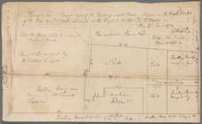
… of
Samuel
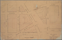
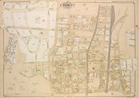
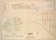
B. Ruggles in the Twelfth
Ward
of the City
note:
Samuel
Bulkley Ruggles (1800-1881
Plan of the city of Philadelp…
abstract:
Shows
wards
, rail
Map of Philadelphia photograp…
note:
Prepared expressly for an index thereto by
Samuel
Map of Philadelphia photograp…
note:
Prepared expressly for an index thereto by
Samuel
Plan of the city of Philadelp…
abstract:
… -- Agricultural Hall. Shows
ward
County map of the state of Ca…
abstract:
…,
wards
, and public
m
County & township map of the …
abstract:
… street names,
wards
m
Samuel
Farmer's house and lot near
note:
… in the Dock
Ward
.
Map of the city of Worcester
abstract:
Shows city
wards
, churches, schools, streets
Map of the City of Springfiel…
note:
Shows city
wards
, streets, railroads
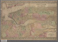
Map of Massachusetts, Connect…
note:
Includes inset map of Boston, colored by
ward
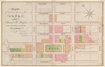
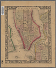
New York and Brooklyn
note:
…,
wards
, parks, ferry
A new map of the city of New …
note:
Shows
ward
boundaries.
… and 17th
wards
, City
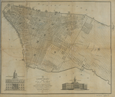
Plan of New York &c.
note:
Shows political
wards
by number
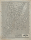
City of New York, 1843.
note:
…. Morse and
Samuel
Breese
… Road,
Samuel
St
…
Ward
; [Map bounded
collection:
….,
Samuel
St., William St
….,
Samuel
St., Gilbert St
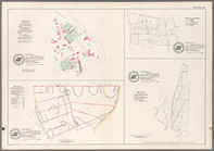
City of Washington.
note:
Shows
wards
, built-up areas, and major
End of results
|
Top