Click to visit the main New York Public Library Homepage
The New York Public Library
Digital Collections
About Digital Collections
Browse
Search only public domain materials
Items
Collections
Divisions
Home
Search
Browse
About
Search only public domain materials
Items
Collections
Divisions
Digital Collections
Using Images
Using Data
Search
Filtered keyword search
Show filters
Hide filters
Show Only Public Domain
topic
Harbors
136
Nautical charts
122
Real property
39
Coasts
23
City planning
19
More
Less
name
United States Coast Survey
75
Bache, A. D. (Alexander Dallas), 1806-1867
59
Mathiot, G
18
Whiting, Henry L
14
M.I.T. Press
12
More
Less
collection
Maps of North America
198
Maps of New York City and State
65
Atlases of New York City
40
Atlases of the United States
29
Lawrence H. Slaughter Collection of English maps, charts, globes, books and atlases
19
More
Less
place
New York (State)
80
Massachusetts
55
New York (N.Y.)
51
New York Harbor (N.Y. and N.J.)
38
New York
32
More
Less
genre
x
Maps
Nautical charts
76
Bathymetric maps
43
Atlases
29
Cadastral maps
15
More
Less
publisher
U.S. Coast Survey
25
publisher not identified
20
U.S. Coast Survey Office
16
MIT Press
12
E. Belcher Hyde
9
More
Less
division
Map Division
366
Manuscripts and Archives Division
1
Rare Book Division
1
Schomburg Manuscripts, Archives and Rare Books Division
1
type
cartographic
357
still image
21
text
3
Date Range
to
369 results found for:
x
new york harbor
Filtering on:
x
Genre
: Maps
Sort by:
Relevance
Title
Date created
Date digitized
Sequence
…
Harbor
, Rockaway Park
collection:
Plan for
New
York
City 1969: a proposal
…, Neponsit, Belle
Harbor
collection:
Plan for
New
York
City 1969: a proposal
…, Neponsit, Belle
Harbor
collection:
Plan for
New
York
City 1969: a proposal
…, Neponsit, Belle
Harbor
collection:
Plan for
New
York
City 1969: a proposal
…, Neponsit, Belle
Harbor
collection:
Plan for
New
York
City 1969: a proposal
…, Neponsit, Belle
Harbor
collection:
Plan for
New
York
City 1969: a proposal
…, Mariner's
Harbor
, Meiers
collection:
Plan for
New
York
City 1969: a proposal
…, Mariner's
Harbor
, Meiers
collection:
Plan for
New
York
City 1969: a proposal
…, Mariner's
Harbor
, Meiers
collection:
Plan for
New
York
City 1969: a proposal
…, Mariner's
Harbor
, Meiers
collection:
Plan for
New
York
City 1969: a proposal
…, Mariner's
Harbor
, Meiers
collection:
Plan for
New
York
City 1969: a proposal
…, Mariner's
Harbor
, Meiers
collection:
Plan for
New
York
City 1969: a proposal
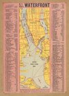
N.Y. City's waterfront.
use:
… partner (e.g.,
New
York
City of
New
Manhattan : proposed May
use:
… partner (e.g.,
New
York
Manhattan: W. 34th St. to W. …
use:
… partner (e.g.,
New
York
…), South Ave,
Harbor
RD
use:
… partner (e.g.,
New
York
… (Columbus),
Harbor
Road
use:
… partner (e.g.,
New
York
… by Maryland Ave,
New
York
Bay
use:
… partner (e.g.,
New
York
Part of Sag
Harbor
use:
… partner (e.g.,
New
York
Part of Sag
Harbor
use:
… partner (e.g.,
New
York
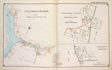
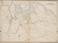
Cold Spring
Harbor
; Cedar Grove Terrace
use:
… partner (e.g.,
New
York
… map of the Port of
New
York
use:
… partner (e.g.,
New
York
…., Meadow Lane,
New
Rochelle
Harbor
, Long Island Sound
use:
… partner (e.g.,
New
York
… by Mamaroneck
Harbor
, Long
use:
… partner (e.g.,
New
York
…
Harbor
, Oakhurst Ave.]
use:
… partner (e.g.,
New
York
…, Milton
Harbor
,
York
Ave
use:
… partner (e.g.,
New
York
…
Harbor
Road.
use:
… partner (e.g.,
New
York
Plate 11: Bounded by Juniper …
use:
… partner (e.g.,
New
York
….,
Harbor
Road, Sylvan Pl
use:
… partner (e.g.,
New
York
… Lane, Dry
Harbor
, Hnson
use:
… partner (e.g.,
New
York
…, Furmanville Road, Dry
Harbor
use:
… partner (e.g.,
New
York
… by Johnson Ave.,
Harbor
Road
use:
… partner (e.g.,
New
York
… Road), Dry
Harbor
Road
use:
… partner (e.g.,
New
York
Plate 2 Part of Ward 1: [Map …
use:
… partner (e.g.,
New
York
Plate 3, Part of Ward 1 : [Ma…
use:
… partner (e.g.,
New
York
…,
New
York
&
New
Jersey
use:
… partner (e.g.,
New
York
…
Harbor
(Livingston
use:
… partner (e.g.,
New
York
Sheet No. 14. [Includes Mariners
Harbor
use:
… partner (e.g.,
New
York
…
Harbor
, Brighton Heights
use:
… partner (e.g.,
New
York
Outline map of
New
York
Harbor
& vicinity
use:
… partner (e.g.,
New
York
…
Harbor
Road, Trotting
use:
… partner (e.g.,
New
York
…
Harbor
Road, Boundary
use:
… partner (e.g.,
New
York
…
Harbor
]
use:
… partner (e.g.,
New
York
…, Rocky Point
Harbor
use:
… partner (e.g.,
New
York
… by Cold Spring
Harbor
use:
… partner (e.g.,
New
York
…
Harbor
, James St., Ocean
use:
… partner (e.g.,
New
York
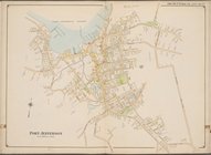
… by Jefferson
Harbor
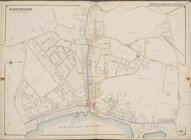
, Port
use:
… partner (e.g.,
New
York
… by Port Jefferson
Harbor
use:
… partner (e.g.,
New
York
…., Green Point
Harbor
]
use:
… partner (e.g.,
New
York
Hawaiian Islands
use:
… partner (e.g.,
New
York
1
2
Previous
Next
1
2
Previous
Next