Click to visit the main New York Public Library Homepage
The New York Public Library
Digital Collections
About Digital Collections
Browse
Search only public domain materials
Items
Collections
Divisions
Home
Search
Browse
About
Search only public domain materials
Items
Collections
Divisions
Digital Collections
Using Images
Using Data
Search
Filtered search
Show filters
Hide filters
Show Only Public Domain
topic
Landowners
17
Real property
14
Administrative and political divisions
7
Villages
7
Cities and towns
6
More
Less
name
x
Smith, Robert Pearsall, 1827-1898
Balch, E. A
4
Geil, Samuel
3
Chace, J
2
Fagan, L
2
More
Less
collection
Maps of New York City and State
16
Maps of North America
2
place
New York (State)
16
Lincoln County
2
Lincoln County (Me.)
2
Maine
2
Troy (N.Y.)
2
More
Less
genre
x
Cadastral maps
Maps
18
Illustrations
1
Pictorial works
1
Topographic maps
1
publisher
E.A. Balch
2
Lee & Marsh
2
A.O. Gallup & Co
1
E.A. Balch & W.O. Shearer
1
E.D. Marsh, publisher
1
More
Less
division
Map Division
18
type
cartographic
18
still image
2
Date Range
to
18 results found
Filtering on:
x
Genre
: Cadastral maps
x
Name
: Smith, Robert Pearsall, 1827-1898
Sort by:
Title
Date created
Date digitized
Sequence
m
Map of Washington County, New…
m
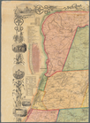
A topographical map of Lincol…
m
Map of Suffolk Co., L.I., New…
m
Map of Tioga County, New York…
m
A topographical map of Lincol…
Map of Rockland Co: [New York]
m
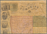
Map of Tompkins County, New Y…
Map of Chenango County, New Y…
m
Map of the vicinity of Albany…
m
Gillette's map of Oneida Co.,…
Map of Sullivan County, New Y…
Map of Broome County, New York
Map of Erie County, New York:…
m
Map of Rensselaer County, New…
Map of Warren Co., New York
Map of Essex Co., New York
A topographical map of Lewis …
Map of Saratoga Co., New York…
End of results
|
Top