Click to visit the main New York Public Library Homepage
The New York Public Library
Digital Collections
About Digital Collections
Browse
Search only public domain materials
Items
Collections
Divisions
Home
Search
Browse
About
Search only public domain materials
Items
Collections
Divisions
Digital Collections
Using Images
Using Data
Search
Filtered keyword search
Show filters
Hide filters
Show Only Public Domain
topic
x
Railroads
Real property
20
Landowners
16
Administrative and political divisions
7
Roads
7
More
Less
name
Britton & Rey
2
Dripps, M. (Matthew)
2
Smith, Robert Pearsall, 1827-1898
2
Welcke, Robert A
2
Beers, S. N
1
More
Less
collection
Maps of New York City and State
17
Maps of North America
7
place
New York (State)
16
New York
8
New York (N.Y.)
4
Bensonhurst (New York, N.Y.)
2
Brooklyn (New York, N.Y.)
2
More
Less
genre
x
Cadastral maps
Maps
24
Manuscript maps
2
Topographic maps
1
publisher
publisher not identified
5
M. Dripps
2
E. Belcher Hyde
1
G.W. & C.B. Colton & Co
1
Geo. D. Bolton
1
More
Less
division
Map Division
24
type
x
cartographic
Date Range
to
24 results found for:
x
New York Maps
Filtering on:
x
Genre
: Cadastral maps
x
Topic
: Railroads
x
Type
: cartographic
Sort by:
Relevance
Title
Date created
Date digitized
Sequence
Springfield, Ill. 1892
use:
… partner (e.g.,
New
York
Plan showing route of Rochest…
use:
… partner (e.g.,
New
York
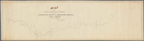
Map
of a preliminary survey
use:
… partner (e.g.,
New
York
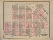
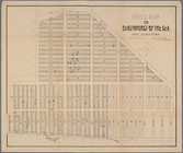
Index
map
to Bensonhurst-by-the Sea
use:
… partner (e.g.,
New
York
m
… Boro[ugh], city of
New
York
use:
… partner (e.g.,
New
York
Map
of part of Orange County,
New
York
use:
… partner (e.g.,
New
York
Index
map
to Bensonhurst-by-the-Sea
use:
… partner (e.g.,
New
York
Map
of Rockland Co
use:
… partner (e.g.,
New
York
Portion of the copper distric…
use:
… partner (e.g.,
New
York
A topographical
map
of Lewis Co.,
New
York
use:
… partner (e.g.,
New
York
Map
of the town of Huron, Michigan
use:
… partner (e.g.,
New
York
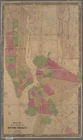
Map
of the cities of
New
York
and Brooklyn
use:
… partner (e.g.,
New
York
m
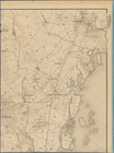
Map
of upper
New
York
City and adjacent
use:
… partner (e.g.,
New
York
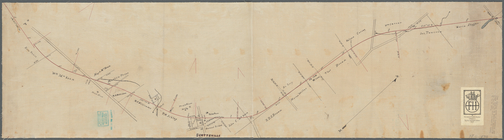
Railroad
map
of the City of San Francisco
use:
… partner (e.g.,
New
York
Railroad
map
of the City of San Francisco
use:
… partner (e.g.,
New
York
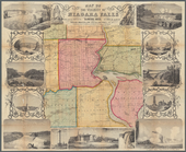
Map
of the vicinity of Niagara Falls
use:
… partner (e.g.,
New
York
m
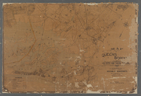
Map
of the borough of Queens, City of
New
York
…
use:
… partner (e.g.,
New
York
…, State of
New
York
use:
… partner (e.g.,
New
York
m
Higginson's
map
of
New
York
and vicinity
use:
… partner (e.g.,
New
York
Iron Mountain City : [Missour…
use:
… partner (e.g.,
New
York
m
Schuyler County,
New
York
, with plans
use:
… partner (e.g.,
New
York
m
Map
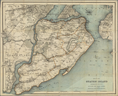
of Staten Island (Richmond Co.) N.Y
use:
… partner (e.g.,
New
York
m
Map
of Rockland County,
New
York
use:
… partner (e.g.,
New
York
Map
of Omaha and Council Bluffs & environs …
use:
… partner (e.g.,
New
York
End of results
|
Top