Click to visit the main New York Public Library Homepage
The New York Public Library
Digital Collections
About Digital Collections
Browse
Search only public domain materials
Items
Collections
Divisions
Home
Search
Browse
About
Search only public domain materials
Items
Collections
Divisions
Digital Collections
Using Images
Using Data
Search
Filtered keyword search
Show filters
Hide filters
Show Only Public Domain
topic
Real property
102
Landowners
36
Administrative and political divisions
9
City planning
6
Villages
5
More
Less
name
G.W. Bromley & Co
52
Smith, Robert Pearsall, 1827-1898
7
Beers, S. N
3
Davis, Thomas W. (Surveyor)
3
French, J. H. (John Homer), 1824-1888
3
More
Less
collection
Atlases of New York City
52
Maps of New York City and State
29
Maps of North America
21
Collection of broadside real estate maps announcing auctions of lots in early 19th century New York City
3
place
New York (N.Y.)
54
Queens (New York, N.Y.)
53
New York (State)
32
Massachusetts
6
Manhattan (New York, N.Y.)
5
More
Less
genre
x
Cadastral maps
Maps
105
Illustrations
1
Manuscript maps
1
Topographic maps
1
publisher
G. W. Bromley & Co
52
publisher not identified
10
J.B. Beers & Co
2
A.G. Gillett Publisher
1
A.P. Hartmann
1
More
Less
division
Map Division
105
type
cartographic
101
text
5
still image
1
Date Range
to
105 results found for:
x
City planning
Filtering on:
x
Genre
: Cadastral maps
Sort by:
Relevance
Title
Date created
Date digitized
Sequence
Map of New Covington, in St. …
topic:
City
planning
Plan
of burnt district (by fire of Nov
note:
Thos. W. Davis,
city
surveyor.
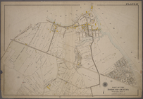
Map of land to be acquired un…
topic:
City
planning
Plan
of Public Garden
note:
… Garden, July, 1850 (
City
Map of the Melrose addition to Roanoke
City
topic:
City
planning
m
Map of the
City
of New York north
note:
…,
City
Surveyor, 78 Cedar
Plat of the
city
of Tallapoosa, Haralson Co
topic:
Regional
planning
Plan
of Church St. district
note:
…,
city
surveyor.
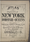
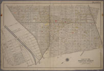
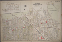
Atlas of the
City
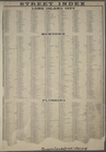
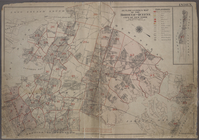
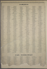
STREET INDEX: Long Island
City
-- Newtown
… of Queens,
City
of New York.
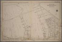
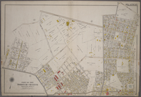
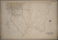
m
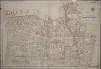
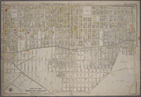
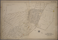
Plate 2: Bounded by (East Riv…
collection:
Part of the Borough of Queens, Long Island
City
STREET INDEX: Jamaica -- Far …
collection:
Atlas of the
city
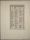
Index to Localities and Sub-D…
collection:
Atlas of the
city
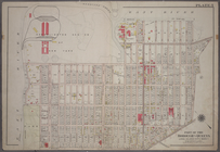
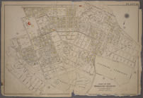
m
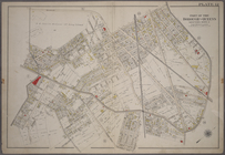
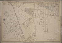
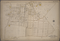
Plate 1: Bounded by (East Riv…
collection:
Part of the Borough of Queens, Long Island
City
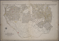
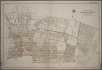
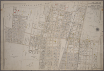
Plate 3:Bounded by (Dutch Kil…
collection:
Part of the Borough of Queens, Long Island
City
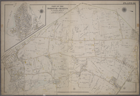
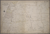
Plate 4: Bounded by Rapelje A…
collection:
Part of the Borough of Queens, Long Island
City
Plate 5: Bounded by (Con. Ed.…
collection:
Part of the Borough of Queens, Long Island
City
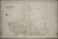
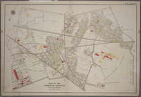
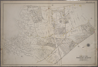
Plate 26: Willets Point Road …
collection:
Atlas of the
city
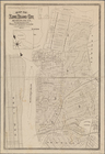
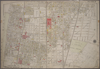
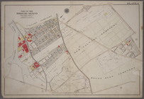
Map of Long Island
City
, Queens Co. N.Y.
abstract:
…, streetcar lines,
planned
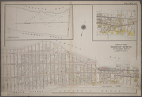
Plate 38: Bounded by Hillside…
collection:
Atlas of the
city
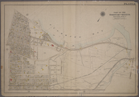
Plate 12: Bounded by Maurice …
collection:
Atlas of the
city
Plate 14: Bounded by Railroad…
collection:
Atlas of the
city
Plate 30: Bounded by Nassau R…
collection:
Atlas of the
city
Plate 33: Bounded by Atlantic…
collection:
Atlas of the
city
Plate 44: Bounded by (Baniste…
collection:
Atlas of the
city
Plate 46: Bounded by (Jamaiac…
collection:
Atlas of the
city
Plate 47: Bounded by (Jamaica…
collection:
Atlas of the
city
Plate 7: Bounded by Maspeth A…
collection:
Atlas of the
city
Plate 10: Bounded by Trotting…
collection:
Atlas of the
city
Plate 16: Bounded by Flushing…
collection:
Atlas of the
city
Plate 18: Bounded by Remsen S…
collection:
Atlas of the
city
Plate 28: Bounded by Whitesto…
collection:
Atlas of the
city
Plate 31: Bounded by New York…
collection:
Atlas of the
city
Plate 37: Bounded by Atlantic…
collection:
Atlas of the
city
Plate 40: Bounded by Old Sout…
collection:
Atlas of the
city
Plate 41: Bounded by Bergen L…
collection:
Atlas of the
city
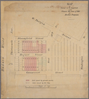
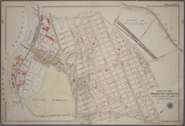
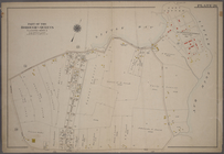
Plan
showing land owned by the Woburn
City
note:
…"Copyrighted by the Woburn
City
Land
Plate 32: Bounded by (Forest …
note:
Includes Sub
Plan
of Maple Hill Park
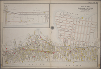
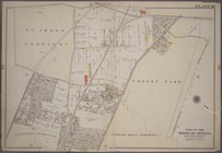
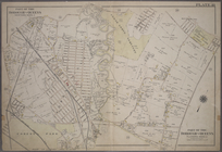
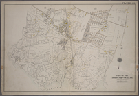
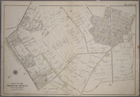
Plate 6: Bounded by Laurel Hi…
collection:
Atlas of the
city
Plate 11: Bounded by Juniper …
collection:
Atlas of the
city
Plate 15: Bounded by Meadow R…
collection:
Atlas of the
city
Plate 17: Bounded by Bowery B…
collection:
Atlas of the
city
Plate 20: Bounded by Sanford …
collection:
Atlas of the
city
Plate 21: Bounded by (Mill Cr…
collection:
Atlas of the
city
Plate 22: Bounded by Fifth Av…
collection:
Atlas of the
city
Plate 24: Bounded by Third Av…
collection:
Atlas of the
city
Plate 27: Bounded by Bell Ave…
collection:
Atlas of the
city
Plate 29: Bounded by Fresh Me…
collection:
Atlas of the
city
Plate 36: Bounded by (Jamaica…
collection:
Atlas of the
city