Click to visit the main New York Public Library Homepage
The New York Public Library
Digital Collections
About Digital Collections
Browse
Search only public domain materials
Items
Collections
Divisions
Home
Search
Browse
About
Search only public domain materials
Items
Collections
Divisions
Digital Collections
Using Images
Using Data
Search
Filtered keyword search
Show filters
Hide filters
Show Only Public Domain
topic
Description and travel
16
Angels
4
Animals
3
Clothing & dress
2
Missions
2
More
Less
name
Ogilby, John (1600-1676)
12
Noble, Frederick Perry
2
American Colonization Society
1
Carey, Mathew, 1760-1839
1
Crowther, Samuel, 1806?-1891
1
More
Less
collection
Africa: being an accurate description of the regions of Ægypt, Barbary, Lybia, and Billedulgerid, the land of Negroes, Guinee, Æthiopia, and the Abyssines, with all the adjacent islands ... collected and translated from most authentick authors ... by John Ogilby ..
12
Description de l'univers ..
5
Relation universelle de l'Afrique, ancienne et moderne
5
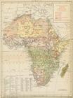
The earth and its inhabitants, Africa
3
The Black Experience in Children's Books: Selections from Augusta Baker's Bibliographies
2
More
Less
place
x
Africa
Islands of the Atlantic
12
Islands of the Indian Ocean
12
South Africa
12
Liberia
3
More
Less
genre
x
Illustrations
Maps
13
Prints
12
Photographs
4
Books
2
More
Less
publisher
D. Thierry
5
T. Amaulry
5
D. Appleton
3
F. H. Revell
2
Fleming H. Revell Company
1
More
Less
division
General Research Division
13
Schomburg Manuscripts, Archives and Rare Books Division
13
Schomburg Jean Blackwell Hutson Research and Reference Division
11
type
cartographic
29
still image
9
text
2
Date Range
to
37 results found for:
x
Africa maps
Filtering on:
x
Genre
: Illustrations
x
Place
: Africa
Sort by:
Relevance
Title
Date created
Date digitized
Sequence
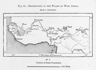
Distribution of Fulahs in West
Africa
.
m
South and Central
Africa
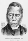
Samuel Adjai Crowther, D.D.; …
collection:
… of
Africa
; a story of civilization, with
maps
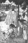
The Reverend W. W. Sheppard.
collection:
… of
Africa
; a story of civilization, with
maps
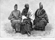
Toucouleur types - the interp…
collection:
The earth and its inhabitants,
Africa
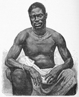
Agni type.
collection:
The earth and its inhabitants,
Africa
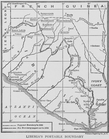
Liberia's portable boundary
collection:
… and shadows across
Africa
The Negro in West
Africa
: Liberian
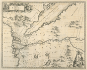
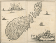
Isle de Malthe
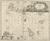
Isles dv Cap Verd
I. Goree
L"empire du Monomotapa et la …
Afrique Ancienne
Afrique Moderne
Congo
Le Ruyavme d Abyssinie ou lem…
Isle de Madagascar dite de St…
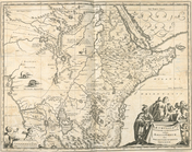
Partie Septentrionale de L'An…
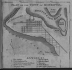
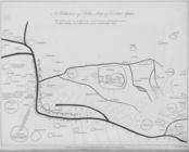
Plan of the Town of Monrovia
Affairs of West
Africa
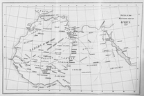
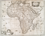
Racial and Linguistic
Map
of
Africa
Nova Aegypti Tabula.
collection:
Africa
: being an accurate description
Barbaria Biledulgered o: Liby…
collection:
Africa
: being an accurate description
Fezzae et Marocchi Regna
Africae
Africae
Accurata Tabula ex Officina
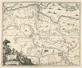
Nigritarum Regio.
collection:
Africa
: being an accurate description
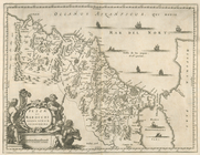
Gvinea.
collection:
Africa
: being an accurate description
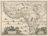
Regna Congo et Angola.
collection:
Africa
: being an accurate description
Insvla S. Lavrentii, vulgo Ma…
collection:
Africa
: being an accurate description
Insulae Canariae alias Fortun…
collection:
Africa
: being an accurate description
Melite Insula vulgo Masia.
collection:
Africa
: being an accurate description
Aethipia Superior vel Interio…
collection:
Africa
: being an accurate description
Insulae Promontori Viridis, H…
collection:
Africa
: being an accurate description
… of Bello's
Map
of Central
Africa
. The dotted parts
Sketch
map
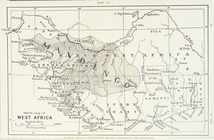
fo West
Africa
.
m
Africa
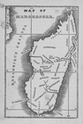
Map
of Madagascar
End of results
|
Top