Click to visit the main New York Public Library Homepage
The New York Public Library
Digital Collections
About Digital Collections
Browse
Search only public domain materials
Items
Collections
Divisions
Home
Search
Browse
About
Search only public domain materials
Items
Collections
Divisions
Digital Collections
Using Images
Using Data
Search
Filtered search
Show filters
Hide filters
Show Only Public Domain
topic
Real property
10094
Fire insurance
5206
Cities & towns
4996
City planning
990
Social conditions
943
More
Less
name
Sanborn Map Company
5080
G.W. Bromley & Co
2113
M.I.T. Press
942
New York (N.Y.). City Planning Commission
942
Ullitz, Hugo
688
More
Less
collection
Atlases of New York City
9643
Atlases of the United States
1870
Maps of New York City and State
1304
Collection of broadside real estate maps announcing auctions of lots in early 19th century New York City
67
Maps of North America
45
More
Less
place
x
New York (State)
New York
4913
Manhattan (New York, N.Y.)
2229
New York (N.Y.)
2152
Brooklyn (New York, N.Y.)
939
More
Less
genre
x
Maps
Atlases
1869
Cadastral maps
247
Index maps
65
Manuscript maps
61
More
Less
publisher
Sanborn Map Company
4998
G.W. Bromley & Co
1988
MIT Press
942
E. Belcher Hyde
520
E. Robinson Co
240
More
Less
division
Map Division
12829
Manuscripts and Archives Division
32
Rare Book Division
11
General Research Division
7
Wallach Division: Print Collection
6
More
Less
type
cartographic
12022
still image
966
text
149
Date Range
to
13,020 results found
Filtering on:
x
Genre
: Maps
x
Place
: New York (State)
Sort by:
Title
Date created
Date digitized
Sequence
Results 251 - 300
Upper Manhattan, comprising t…
The lower end of Manhattan Is…
The southeastern part of the …
The southwestern part of the …
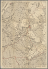
The northwesterly part of the…
The district of Pelham Neck, …
Southeastern part of the boro…
Werpoes, a village of the Man…
Yorkville and East Harlem in …
Southern part of the borough …
The Long Island City and Newt…
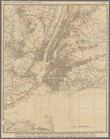
Greater New York and contigou…
Colton's railroad & township …
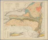
Economic and geologic map of …
Preliminary geologic map of A…
m
Map of Long Island and the so…
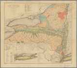
Economic and geologic map of …
Map of the state of New York:…
Map of the rail roads of the …
Economic and geologic map of …
m
Map of the southern part of W…
m
Map of Ulster County, New York
Map of the rail-roads of the …
Map of the rail roads of the …
Map shewing the location of t…
m
Map of Washington County, New…
Map of the American Coast, fr…
Map showing locations of Dela…
Map showing comparison betwee…
Proposed Metropolitan Freight…
Map of Proposed Belt Railways…
Preliminary Study for a Great…
Map showing relation of the I…
H4. Map (Scheme B) illustrati…
Map of the boundary line betw…
Map of the boundary lines bet…
Map showing the New York and …
Map of the frontiers of the n…
m
Hagstrom's map of Queens N.Y.…
m
Hagstrom's map of Brooklyn (N…
m
Shell street guide of Brookly…
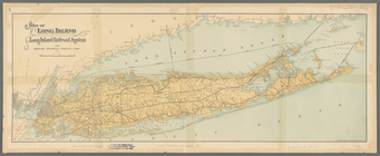
Map of Long Island showing th…
m
Hagstom's map of Long Island …
Map of the port & vicinity of…
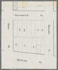
Horatio Street, Hudson Street…
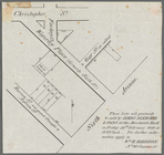
These lots will positively be…
Gansevoort Street, 9th Avenue…
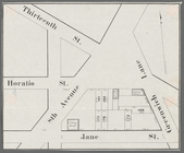
Jane Street, Eighth Avenue, T…
Thirteenth Street, Greenwich …
m
Map of lots to be sold at auc…
1
2
3
4
5
6
7
8
9
10
…
52
53
Previous
Next
1
2
3
4
5
6
7
8
9
10
…
52
53
Previous
Next