Click to visit the main New York Public Library Homepage
The New York Public Library
Digital Collections
About Digital Collections
Browse
Search only public domain materials
Items
Collections
Divisions
Home
Search
Browse
About
Search only public domain materials
Items
Collections
Divisions
Digital Collections
Using Images
Using Data
Search
Filtered search
Show filters
Hide filters
Show Only Public Domain
topic
Nautical charts
3
Administrative and political divisions
2
Harbors
2
Coasts
1
Real property
1
More
Less
name
x
Hooker, William, 1782-1856
E. & G.W. Blunt (Firm)
2
Bache, Hartman, 1797-1872
1
Blunt, Edmund M. (Edmund March), 1770-1862
1
Eddy, John H. (John Hartshorne), 1783-1817
1
More
Less
collection
Maps of New York City and State
3
Maps of North America
2
I. N. Phelps Stokes Collection of American Historical Prints
1
Maps of the Oceans
1
place
New York (N.Y.)
3
Manhattan (New York, N.Y.)
2
Maps
2
Administrative and political divisions
1
Atlantic Coast
1
More
Less
genre
x
Maps
Nautical charts
2
Bathymetric maps
1
Cadastral maps
1
publisher
A.W. Wilgus
1
E. & G.W. Blunt, No. 179 Water Street, corner of Burling Slip
1
Peabody & Co
1
Published by E. & G.W. Blunt
1
Published by Prior & Dunning, map & chart sellers, No. 111 Water Street,
1
More
Less
division
Map Division
6
Wallach Division: Print Collection
1
type
cartographic
7
text
1
Date Range
to
7 results found
Filtering on:
x
Genre
: Maps
x
Name
: Hooker, William, 1782-1856
Sort by:
Title
Date created
Date digitized
Sequence
Charleston harbour, S. Ca. : …
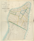
Map of the city of Buffalo
Coast chart from Cape Hattera…
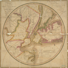
Map of the country thirty mil…
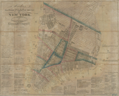
Hooker's new pocket plan of t…
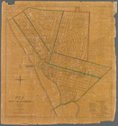
Map of the city of New York.
Chart of the Atlantic Ocean :…