Click to visit the main New York Public Library Homepage
The New York Public Library
Digital Collections
About Digital Collections
Browse
Search only public domain materials
Items
Collections
Divisions
Home
Search
Browse
About
Search only public domain materials
Items
Collections
Divisions
Digital Collections
Using Images
Using Data
Search
Filtered search
Show filters
Hide filters
Show Only Public Domain
topic
Real property
311
Fire insurance
195
Cities & towns
190
History
11
Bunker Hill, Battle of, Boston, Mass., 1775
9
More
Less
name
Sanborn Map Company
191
Ullitz, Hugo
69
E. Belcher Hyde Map Company
65
E.B. Hyde & Co
65
G.W. Bromley & Co
35
More
Less
collection
Atlases of New York City
365
Atlases of the United States
42
Maps of North America
29
Maps of New York City and State
17
Bancker plans
3
More
Less
place
New York (State)
320
New York
107
Brooklyn (New York, N.Y.)
75
Maps
58
New York (N.Y.)
44
More
Less
genre
x
Maps
Atlases
42
Cadastral maps
11
Index maps
4
Manuscript maps
4
More
Less
publisher
Sanborn Map Company
192
E. Belcher Hyde
72
G.W. Bromley & Co
28
E. Belcher Hyde
15
Government Printing Office
8
More
Less
division
Map Division
456
General Research Division
4
Manuscripts and Archives Division
3
Wallach Division: Picture Collection
3
Schomburg Jean Blackwell Hutson Research and Reference Division
2
More
Less
type
cartographic
466
text
5
still image
4
Date Range
to
472 results found
Filtering on:
x
Genre
: Maps
x
Note
: "Begun Jan., 1826 Finished June 18, 1826." Some pencil notes on front fly-leaf and date 1837, Wednesday, May 16th morning. Pressed flowers, removed from book and put in six mylar sheathes with card, in separate envelope.
Sort by:
Title
Date created
Date digitized
Sequence
m
Map of the Cedar Knolls, at B…
m
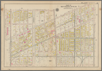
Map 18 - Brooklyn and Queens
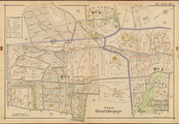
Town of West Orange, Double P…
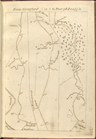
Sketch of the action on the h…
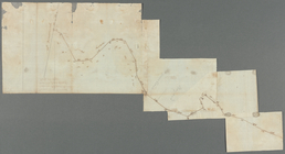
Plan showing the redoubt, bre…
Sketch of the action on the h…
Bounded by Ditmas Avenue, Con…
Bounded by 43rd Street, West …
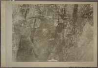
18A - N.Y. City (Aerial Set).
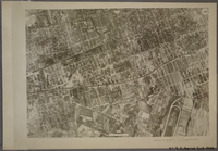
18B - N.Y. City (Aerial Set).
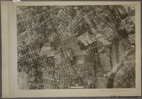
18C - N.Y. City (Aerial Set).
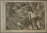
18D - N.Y. City (Aerial Set).
m
Map of 19 lots in the fifteen…
m
Map of a water grant between …
Map of the city of Washington…
m
1793 March 18
m
1803 April, June 1803
m
Courses between Ridgener's Me…
Map of the city of Washington…
Map of the city of Washington…
Map of the city of Washington…
Map of the city of Washington…
Map of the city of Washington…
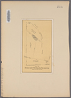
A Plan of the action at Bunke…
Map of the city of Washington…
Map of the city of Washington…
Map of the city of Washington…
Rapid Transit Commission, map…
Plan of the town of Boston wi…
Sketch of the action on the h…
A plan of the action at Bunke…
Map showing private land clai…
Map showing the public domain…
Precious metal regions of the…
Map of New Netherland which w…
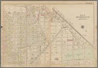
Plate 18
7th Senatorial District 18, 2…
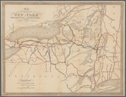
Map of the state of New-York …
Information map, Hd. Qrs, 20t…
m
Position Army Cumbld., June 2…
Information map only, H. Qrs.…
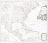
A new map of North America wi…
From Stratford (18) to Poughk…
Road from Philadela. to Washi…
Map of Old Jan's land & the B…
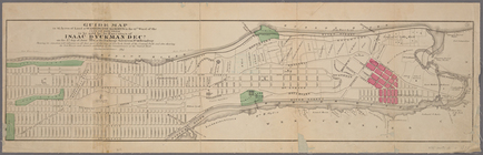
Guide map to 92 acres of land…
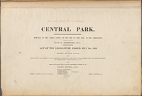
Central Park : memorial of th…
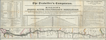
Morrison's North River travel…
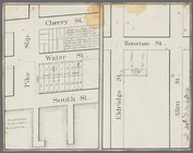
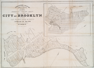
Executors sale of property be…
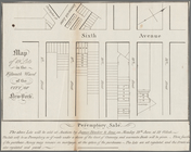
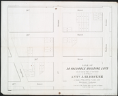
Sale of 30 valuable building …
1
2
Previous
Next
1
2
Previous
Next