Click to visit the main New York Public Library Homepage
The New York Public Library
Digital Collections
About Digital Collections
Browse
Search only public domain materials
Items
Collections
Divisions
Home
Search
Browse
About
Search only public domain materials
Items
Collections
Divisions
Digital Collections
Using Images
Using Data
Search
Filtered search
Show filters
Hide filters
Show Only Public Domain
topic
Real property
47
Local transit
6
Railroads
6
Railroads, Elevated
5
Piers
3
More
Less
name
E.B. Hyde & Co
24
Ullitz, Hugo
24
E. Belcher Hyde Map Company
19
G.W. Bromley & Co
9
Rand McNally and Company
8
More
Less
collection
Atlases of New York City
45
Maps of New York City and State
13
Collection of broadside real estate maps announcing auctions of lots in early 19th century New York City
2
Lawrence H. Slaughter Collection of English maps, charts, globes, books and atlases
1
Maps of North America
1
More
Less
place
x
New York
New York (State)
62
Brooklyn (New York, N.Y.)
45
Manhattan (New York, N.Y.)
12
Maps
12
More
Less
genre
x
Maps
Cadastral maps
2
Mass transit
1
Pamphlets
1
Road maps
1
publisher
E. Belcher Hyde
20
G.M. Hopkins & Co
7
E.B. Hyde & Co
5
G.W. Bromley & Co
5
E. Robinson Co
4
More
Less
division
Map Division
62
Manuscripts and Archives Division
1
type
cartographic
63
text
1
Date Range
to
63 results found
Filtering on:
x
Genre
: Maps
x
Note
: [10 written pages] in wrapping leaf, with label "To S. H." Possibly by Annie Fields, but author initials not ascertained.
x
Place
: New York
Sort by:
Title
Date created
Date digitized
Sequence
m
Map of property belonging to …
m
Rand, McNally & Co.'s complet…
Rand, McNally & Co.'s new han…
Rand McNally & Co.'s new hand…
m
Rand McNally & Co.'s road map…
Map of portion of greater New…
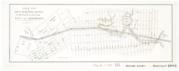
H4. Map (Scheme B) illustrati…
m
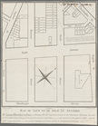
Map of lots to be sold at auc…
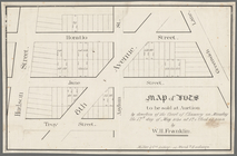
Map of lots to be sold at auc…
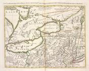
La Pensilvania, la Nuova York…
Plan[s] of Majr. Douglas's re…
Rand, McNally & Co.'s map of …
Rand McNally & Co.'s guide ma…
Rand, McNally & Co.'s new han…
Rand McNally & Co.'s new hand…
Pierhead and bulkhead lines f…
[Bounded by Avenue H, E. 18th…
Bounded by Stillwell Ave., Av…
Plate 45: Bounded by W. 170th…
Plate 49: Bounded by Harlem R…
Plate 9: Bounded by Fulton St…
Plate 20: Bounded by S. 11th …
Plate 21: Bounded by Grand St…
Plate 28: Bounded by S. Schol…
Plate 5: [Bounded by Clermont…
Plate 9: [Bounded by S. 11th …
Plate 10: [Bounded by N. Seco…
Bounded by West Street, Ditma…
Bounded by (U.S. Government R…
Plate 19: [Bounded by 72nd St…
Plate 2, Part of Section 4: […
Map bound by U.S. Navy Yard, …
Map bound by Sands St., U.S. …
Map bound by Conselyea St., B…
Map bound by Grand St., Seven…
Map bound by S. Sixth St., Br…
Map bound by Grand St., Eleve…
Map bound by First St., Secon…
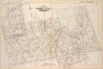
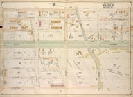
Brooklyn, Vol. 3, Double Page…
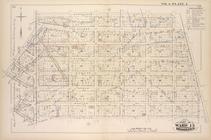
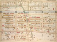
Brooklyn, Vol. 7, Double Page…
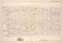
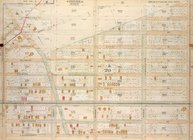
Brooklyn, Vol. 7, Double Page…
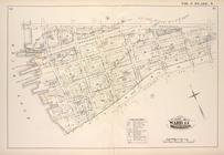
Brooklyn, Vol. 7, Double Page…
Brooklyn, Vol. 7, Double Page…
Brooklyn, Vol. 7, Double Page…
Brooklyn, Vol. 7, Double Page…
Brooklyn, Vol. 7, Double Page…
Brooklyn, Vol. 7, Double Page…
Brooklyn, Vol. 7, Double Page…
Brooklyn, Vol. 7, Double Page…
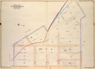
Brooklyn, Vol. 1, 2nd Part, D…