Click to visit the main New York Public Library Homepage
The New York Public Library
Digital Collections
About Digital Collections
Browse
Search only public domain materials
Items
Collections
Divisions
Home
Search
Browse
About
Search only public domain materials
Items
Collections
Divisions
Digital Collections
Using Images
Using Data
Search
Filtered search
Show filters
Hide filters
Show Only Public Domain
topic
Real property
428
Fire insurance
235
Cities & towns
220
Postal service
42
Railroads
27
More
Less
name
Sanborn Map Company
224
Ullitz, Hugo
102
E.B. Hyde & Co
91
E. Belcher Hyde Map Company
84
G.W. Bromley & Co
65
More
Less
collection
Atlases of New York City
544
Atlases of the United States
85
Maps of North America
54
Maps of New York City and State
21
Bancker plans
5
More
Less
place
New York (State)
457
New York
191
Brooklyn (New York, N.Y.)
108
New York (N.Y.)
80
Maps
75
More
Less
genre
x
Maps
Atlases
85
Cadastral maps
9
Surveys
7
Plans
6
More
Less
publisher
Sanborn Map Company
225
E. Belcher Hyde
99
G.W. Bromley & Co
54
E. Robinson Co
26
Post Office Department
20
More
Less
division
Map Division
697
Manuscripts and Archives Division
7
Schomburg Jean Blackwell Hutson Research and Reference Division
4
General Research Division
3
Wallach Division: Picture Collection
3
More
Less
type
cartographic
726
still image
5
text
3
Date Range
to
731 results found
Filtering on:
x
Genre
: Maps
x
Note
: L. S., W. Pitt. Endorsed: "19 Febry 1757 Secretary Pitt. Reced 17 Augt 1757 By Post" 3 pp. Fo
Sort by:
Title
Date created
Date digitized
Sequence
Map of the comprehensive plan…
Map of property in the 19th w…
m
Map 19 - Queens
m
Map 17 - Queens and Brooklyn
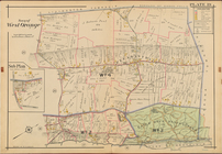
Town of West Orange, Double P…
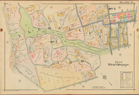
Town of West Orange, Double P…
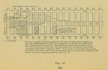
Map (figure 17)
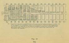
Map (figure 19)
Sketch of the action on the h…
Sketch of the action on the h…
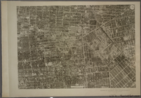
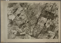
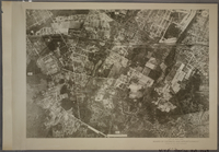
17A - N.Y. City (Aerial Set).
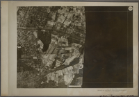
17B - N.Y. City (Aerial Set).
17C - N.Y. City (Aerial Set).
17D - N.Y. City (Aerial Set).
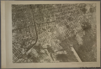
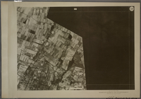
19A - N.Y. City (Aerial Set).
19B - N.Y. City (Aerial Set).
19C - N.Y. City (Aerial Set).
19D - N.Y. City (Aerial Set).
m
Post route map of the state o…
m
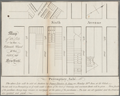
Map of 19 lots in the fifteen…
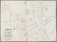
Map of valuable property in t…
m
Post route map of the state o…
m
Post route map of the states …
Post route map of the state o…
Houston Post map of the great…
m
Post route map of the states …
m
Post route map of the state o…
Post route map of the state o…
m
Post route map of the state o…
m
Post route map of the states …
m
Preliminary post route map of…
m
Post route map of the states …
m
Post route map of the State o…
m
Preliminary post route map of…
Post route map of the state o…
m
Post route map of the state o…
Post route map of the States …
Post route map of the states …
m
Post route map of the state o…
Preliminary post route map of…
m
Preliminary post route map of…
m
Post route map of the states …
m
Mount Pitt
m
North, Pitt, Ridge and Stanto…
m
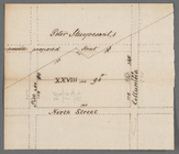
North Stanton, Pitt, and Colu…
m
Sketch of Mount Pitt
m
Columbia to Pitt Street along…
m
Post route map of the states …
m
Post route map of the states …
m
Post route map of the states …
1
2
3
Previous
Next
1
2
3
Previous
Next