Click to visit the main New York Public Library Homepage
The New York Public Library
Digital Collections
About Digital Collections
Browse
Search only public domain materials
Items
Collections
Divisions
Home
Search
Browse
About
Search only public domain materials
Items
Collections
Divisions
Digital Collections
Using Images
Using Data
Search
Filtered keyword search
Show filters
Hide filters
Show Only Public Domain
topic
Nautical charts
6
City planning
3
Harbors
3
Coasts
2
Parks
2
More
Less
name
Des Barres, Joseph F. W. (Joseph Frederick Wallet), 1729-1824
4
Bache, A. D. (Alexander Dallas), 1806-1867
2
Dankworth, Frederick, approximately 1804-
2
Farley, John, 1802 or 1803-1874
2
Ferguson, James, 1710-1776
2
More
Less
collection
Maps of New York City and State
11
Lawrence H. Slaughter Collection of English maps, charts, globes, books and atlases
3
The Eno collection of New York City views
1
place
x
New York (N.Y.)
New York (State)
8
New York
5
New Jersey
4
Manhattan (New York, N.Y.)
3
More
Less
genre
x
Maps
Prints
1
Topographic maps
1
publisher
Published for the use of the Royal Navy of Great Britain by Joseph F. W. Des Barres
2
Survey of the Coast of the United States
2
Aqueduct Commission
1
Board of Public Improvements, Topographical Bureau
1
Eng. by Wm. Bracher,
1
More
Less
division
Map Division
14
Wallach Division: Print Collection
1
type
cartographic
15
Date Range
to
15 results found for:
x
York, Frederick
Filtering on:
x
Genre
: Maps
x
Place
: New York (N.Y.)
Sort by:
Relevance
Title
Date created
Date digitized
Sequence
m
The Tenement-House Committee …
use:
… partner (e.g., New
York
Map or plan showing the stree…
use:
… partner (e.g., New
York
m
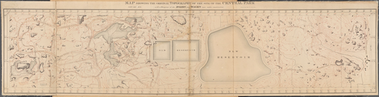
Map of the Central Park
use:
… partner (e.g., New
York
A chart of Delawar River from…
use:
… partner (e.g., New
York
A map of the City of New
York
showing
use:
… partner (e.g., New
York
A sketch of the operations of…
use:
… partner (e.g., New
York
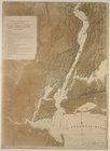
Map Showing the Original Topo…
use:
… partner (e.g., New
York
m
Watson's new map of New
York
and adjacent
use:
… partner (e.g., New
York
m
…
York
City …
use:
… partner (e.g., New
York
A chart of New
York
Harbour
use:
… partner (e.g., New
York
[A chart of New
York
Island & North
use:
… partner (e.g., New
York
A chart of New
York
Island & North River
use:
… partner (e.g., New
York
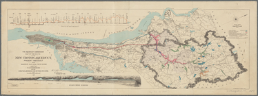
Map of the route of the new C…
use:
… partner (e.g., New
York
Map of New-
York
Bay and Harbor and the environs
use:
… partner (e.g., New
York
Map of New-
York
Bay and Harbor and the environs
use:
… partner (e.g., New
York
End of results
|
Top