Click to visit the main New York Public Library Homepage
The New York Public Library
Digital Collections
About Digital Collections
Browse
Search only public domain materials
Items
Collections
Divisions
Home
Search
Browse
About
Search only public domain materials
Items
Collections
Divisions
Digital Collections
Using Images
Using Data
Search
Filtered keyword search
Show filters
Hide filters
Show Only Public Domain
topic
Real property
133
Railroads
70
Administrative and political divisions
53
Fire insurance
49
Cities & towns
48
More
Less
name
Sanborn Map Company
47
G.W. Bromley & Co
26
United States Coast Survey
18
Burr, David H., 1803-1875
17
Bache, A. D. (Alexander Dallas), 1806-1867
15
More
Less
collection
Maps of North America
231
Maps of New York City and State
114
Atlases of New York City
91
Lawrence H. Slaughter Collection of English maps, charts, globes, books and atlases
28
Atlases of the United States
22
More
Less
place
New York (State)
183
New York
65
New York (N.Y.)
60
New York Metropolitan Area
44
United States
38
More
Less
genre
x
Maps
Cadastral maps
39
Atlases
22
Nautical charts
16
Prints
14
More
Less
publisher
Sanborn Map Company
48
publisher not identified
25
G.W. Bromley & Co
23
Presso Antonio Zatta
12
G.W. & C.B. Colton & Co
10
More
Less
division
Map Division
497
Wallach Division: Print Collection
11
General Research Division
4
Rare Book Division
4
Manuscripts and Archives Division
2
More
Less
type
cartographic
523
still image
13
text
10
Date Range
to
524 results found for:
x
41
Filtering on:
x
Genre
: Maps
Sort by:
Relevance
Title
Date created
Date digitized
Sequence
An old map of Heiankyo (Heian…
note:
Japanese date name: Meiji
41
.
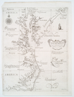
Carta particolare della Virgi…
note:
Lawrence H. Slaughter Collection ;
41
.
A Danish Iron Mine
note:
Dobson 17; Paulson
41
; Tilden II:56a
m
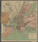
Map of New York City ("greate…
Part of Paulding County, Geor…
Map of the city & county of N…
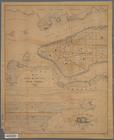
A plan of New York Island wit…
note:
Eno
41
+…
m
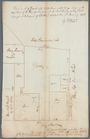
King Street
note:
Block
41
.
m
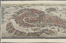
Venetia
Situationsplan
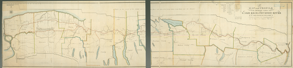
A new map and profile of the …
m
Outline map showing a new rou…
….
41
: [Bounded by Hunt
note:
…'s Avenue. - Map No.
41
: Map
Map of the city & county of N…
Columbia County.
Bounded by Linwood St., Cozin…
parent:
b
41
bf080-c5f7-012f-8fce-58d385a7bc34
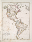
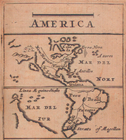
America
note:
…'s Hand-Atlas, No.
41
."…
Faust's map & guide of San Fr…
An old map of Heijokyo (Heijo…
note:
Japanese date name: Meiji
41
.
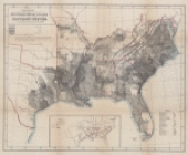
Map showing the distribution …
Geologic map of Orange County…
Plate
41
America.
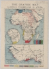
The Graphic map of European p…
Plate
41
, Part of Section 3
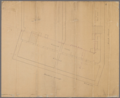
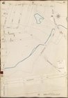
Manuscript map of corner of H…
A plan of Greenville, Norwich…
Map showing the proposed exte…
Grund-Plan der Judengasse im …
Plate
41
, Part of Section 3
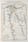
Ægyptus antiqua
Sheet No.
41
. [Includes Fingerboard Road
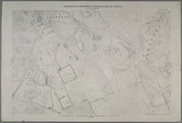
Plan of part of the district …
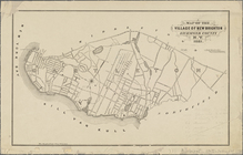
Map of the village of New Bri…
Plymouth town, Mass.
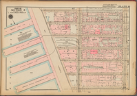
Bronx, V. A, Plate No.
41
[Map bounded
Bronx, V. B, Plate No.
41
[Map bounded
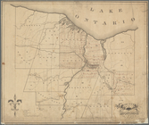
County of Monroe
Map of Brooklyn Manor
Buckwheat, values and yields …
m
Post route map of the states …
note:
… x
41
cm, or smaller
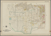
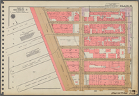
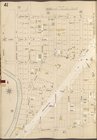
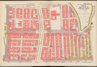
Double Page Plate No.
41
, Part
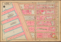
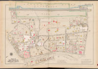
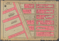
Double Page Plate No.
41
, Part
Map of the United States defi…
Plate
41
, Part of Section 3
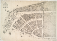
Redraft of the Castello plan
note:
Stokes 1660-B-
41
Kaart der vereenigde staten v…
Map of the United States : dr…
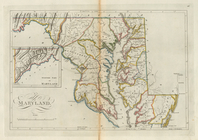
Maryland
The maritime provinces of Chi…
1
2
3
Previous
Next
1
2
3
Previous
Next