Click to visit the main New York Public Library Homepage
The New York Public Library
Digital Collections
About Digital Collections
Browse
Search only public domain materials
Items
Collections
Divisions
Home
Search
Browse
About
Search only public domain materials
Items
Collections
Divisions
Digital Collections
Using Images
Using Data
Search
Filtered keyword search
Show filters
Hide filters
Show Only Public Domain
topic
Nautical charts
8
Coasts
7
Landowners
4
Railroads
4
Surveys
4
More
Less
name
P.S. Duval & Co
27
United States Coast Survey
16
Bache, A. D. (Alexander Dallas), 1806-1867
15
P.S. Duval & Son
7
Knight, C. A
4
More
Less
collection
Maps of North America
34
Maps of New York City and State
2
Lawrence H. Slaughter Collection of English maps, charts, globes, books and atlases
1
place
Florida
7
United States
5
Florida Keys (Fla.)
4
Virginia
4
Michigan
3
More
Less
genre
x
Maps
Nautical charts
8
Bathymetric maps
7
Cadastral maps
3
Geological maps
2
More
Less
publisher
U.S. Coast Survey
13
publisher not identified
6
United States Coast Survey
2
Benj. A. Clark
1
Board of Public Works of Virginia
1
More
Less
division
Map Division
37
type
cartographic
37
Date Range
to
37 results found for:
x
Amaury-Duval
Filtering on:
x
Genre
: Maps
Sort by:
Relevance
Title
Date created
Date digitized
Sequence
United States ca. 1850
Map of the Battlefield of Ant…
Map of the country upon the B…
Approximate cotidal lines of …
Sketch E showing the progress…
note:
…. Philadelphia : P.S.
Duvall
& Co
Tidal currents of Long Island…
note:
…"P.S.
Duval
& Co.'s steam lith. Press
Sketch D, No. 2 showing the p…
note:
…. Philadelphia : P.S.
Duvall
& Co
Map of the proposed line of r…
Map of routes & distances to …
Sketch G : showing the progre…
Sketch D showing the progress…
Map of the United States show…
Sketch E no. 2 : showing the …
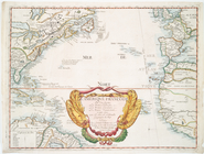
L'Ameriqve françoise, ou son …
Topographical sketch of the g…
Part of New Jersey : embracin…
Philadelphia
Sketch F No. 2 : showing the …
Diagram of the state of Michi…
Map of the city of Jacksonville and suburbs,
Duval
Topographical map of lands be…
Map of comparison of Maffitt'…
Geological map of the distric…
Preliminary survey of Turtle …
Reconnaissance of Coffin's Pa…
Profiles of the canals and ra…
Sketch F, showing the progres…
Map of public surveys in Cali…
Profiles of the canals and ra…
Geological map of Keweenaw Po…
Preliminary chart of the sea …
Preliminary chart of Cedar Ke…
m
New map of Burlington County:…
Town of Greenburgh: Westchest…
Preliminary survey of Winyah …
Map of the mines, canals, and…
Preliminary chart of Beaufort…
End of results
|
Top