Click to visit the main New York Public Library Homepage
The New York Public Library
Digital Collections
About Digital Collections
Browse
Search only public domain materials
Items
Collections
Divisions
Home
Search
Browse
About
Search only public domain materials
Items
Collections
Divisions
Digital Collections
Using Images
Using Data
Search
Filtered keyword search
Show filters
Hide filters
Show Only Public Domain
topic
Railroads
8
Administrative and political divisions
6
Maps
3
Guidebooks
2
Guidebooks, 1802
2
More
Less
name
Perris, William
4
Harrison, William, approximately 1750-1803
3
Stone, William James, 1798-1865
3
Carey, Mathew, 1760-1839
2
Colton, J. H. (Joseph Hutchins), 1800-1893
2
More
Less
collection
Maps of North America
20
Atlases of New York City
5
Lawrence H. Slaughter Collection of English maps, charts, globes, books and atlases
3
Maps of New York City and State
3
Atlases of the United States
2
place
Maine
10
United States
10
New Hampshire
7
New York (State)
7
Brooklyn (New York, N.Y.)
4
More
Less
genre
x
Maps
Atlases
2
Cadastral maps
1
Early maps
1
Early works to 1800
1
More
Less
publisher
publisher not identified
3
M. Carey
2
Post Office Department
2
William Perris
2
Aqueduct Commissioners
1
More
Less
division
Map Division
33
type
cartographic
33
still image
2
Date Range
to
33 results found for:
x
Main%2C William
Filtering on:
x
Genre
: Maps
Sort by:
Relevance
Title
Date created
Date digitized
Sequence
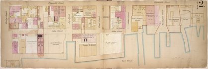
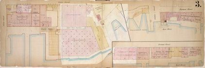
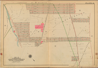
… Street,
Main
Street
…,
Main
Street, York
William
L. Bamber
….,
Main
St., East River
… by
Main
St., Water St
… Street,
William
Street
Map showing the
main
line and branches
Road from Philadela. to New Y…
note:
Engravings by Francis Shallus,
William
… foundation of
main
dam, April
Road from Philadelphia to Was…
note:
Engravings by Francis Shallus,
William
Map of the territory of Flori…
note:
…. Improvement;
William
Tell
Plan of the city of Philadelp…
abstract:
… of
Main
Building
Map of Boston 1875: from A. W…
note:
… lines show proposed
main
….,
Williams
Ave.,
Main
St.]
A new chart of America with t…
note:
… and
Williams
, at the Navigation
The Province of
Maine
, from the best
note:
From: American atlas /
William
A new and accurate map of the…
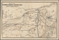
Map of the Fitchburg, Cheshir…
note:
… and Connecticut, portions of
Maine
Map of New England with adjac…
Mt. Washington and vicinity: …
Extract from a map of the Bri…
m
Map of Mount Vernon and envir…
Colton's new railroad & count…
note:
… Michigan and
Maine
.
m
Colton's railroad & commercia…
note:
…
William
St., New York.
Preliminary chart of Kennebec River,
Maine
m
… of
Maine
note:
… of the state of
Maine
for 1790
Post route map of the state of
Maine
note:
… of the state of
Maine
showing
Phelps's national map of the …
note:
Insets: N. part of
Maine
-- Southern part
m
Post route map of the state of
Maine
abstract:
… of the state of
Maine
showing
An accurate map of the District of
Maine
New Hampshire by recent survey
m
City of Washington, statistic…
Map of the boundary lines bet…
End of results
|
Top