Click to visit the main New York Public Library Homepage
The New York Public Library
Digital Collections
About Digital Collections
Browse
Search only public domain materials
Items
Collections
Divisions
Home
Search
Browse
About
Search only public domain materials
Items
Collections
Divisions
Digital Collections
Using Images
Using Data
Search
Filtered keyword search
Show filters
Hide filters
Show Only Public Domain
topic
Geography
2
Postal service
2
Administrative and political divisions
1
Mines and mineral resources
1
Mountains
1
More
Less
name
Nicholson, W. L
3
Gordon, Patrick, active 1700
2
McClelland, D
2
Moll, Herman, -1732
2
Nicholson, John, - approximately 1717
2
More
Less
collection
Maps of North America
5
Lawrence H. Slaughter Collection of English maps, charts, globes, books and atlases
2
place
Early works to 1800
2
Maps
2
Maryland
2
New Jersey
2
Pennsylvania
2
More
Less
genre
x
Maps
publisher
Post Office Department
2
Printed for John Nicholson, John Sprint ...,
2
J. Nicholson,
1
Printed for John Nicholson at the Kings Arms in Little Britain,
1
U.S. Coast Survey
1
division
Map Division
7
type
cartographic
7
Date Range
to
7 results found for:
x
Nicholson, H
Filtering on:
x
Genre
: Maps
Sort by:
Relevance
Title
Date created
Date digitized
Sequence
A new map of Virginia and Mar…
note:
by
H
. Moll geographer.
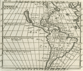
America
collection:
Lawrence
H
. Slaughter Collection
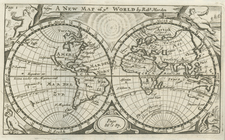
A new map of ye world
collection:
Lawrence
H
. Slaughter Collection
Mountain region of North Caro…
note:
Compiled by W.L.
Nicholson
& A. Lindenkohl
m
Post route map of the states …
note:
…., 1869 ; drawn by C.
H
New England, New York, New Je…
note:
by
H
. Moll, geographer.
m
Post route map of the states …
note:
… by C.
H
. Poole ; engraved