Click to visit the main New York Public Library Homepage
The New York Public Library
Digital Collections
About Digital Collections
Browse
Search only public domain materials
Items
Collections
Divisions
Home
Search
Browse
About
Search only public domain materials
Items
Collections
Divisions
Digital Collections
Using Images
Using Data
Search
Filtered keyword search
Show filters
Hide filters
Show Only Public Domain
topic
Nautical charts
15
Pilot guides
5
Administrative and political divisions
3
Coasts
2
Explorations and surveys
2
More
Less
name
Bache, A. D. (Alexander Dallas), 1806-1867
8
United States Coast Survey
8
Hooker, William
7
Blunt, Edmund M. (Edmund March), 1770-1862
5
Blunt, G. W. (George William), 1802-1878
5
More
Less
collection
Maps of North America
16
Lawrence H. Slaughter Collection of English maps, charts, globes, books and atlases
7
Maps of Europe
1
Maps of New York City and State
1
place
Atlantic Coast (North America)
5
Atlantic Coast (South America)
5
New Jersey
4
Long Island Sound (N.Y. and Conn.)
3
Maryland
3
More
Less
genre
x
Maps
Nautical charts
6
Bathymetric maps
4
Diagrams
2
Geological maps
1
More
Less
publisher
Pub. by E.M. Blunt for W. Hooker
5
U.S. Coast Survey Office
3
U.S. Coast Survey
2
E. & G.W. Blunt
1
G.W. and C.B. Colton & Co
1
More
Less
division
Map Division
25
type
cartographic
25
still image
2
Date Range
to
25 results found for:
x
Williams, G. P., engraver
Filtering on:
x
Genre
: Maps
Sort by:
Relevance
Title
Date created
Date digitized
Sequence
Preliminary survey of Winyah …
use:
… partner (e.
g
., New York
Preliminary chart of Beaufort…
use:
… partner (e.
g
., New York
Map and profile of the Cañada…
use:
… partner (e.
g
., New York
m
Reconnoissance of the western…
use:
… partner (e.
g
., New York
Preliminary chart of St. John…
use:
… partner (e.
g
., New York
Preliminary Chart of Atchafal…
use:
… partner (e.
g
., New York
Mouth of Chester River : (Har…
use:
… partner (e.
g
., New York
Map and profile of the Tejon …
use:
… partner (e.
g
., New York
Mouth of Chester River : (Har…
use:
… partner (e.
g
., New York
Albemarle Sound, N. Carolina,…
use:
… partner (e.
g
., New York
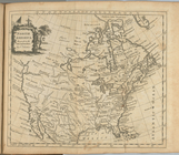
North America
use:
… partner (e.
g
., New York
m
Topographical map of the stat…
use:
… partner (e.
g
., New York
The town of Boston: in New En…
use:
… partner (e.
g
., New York
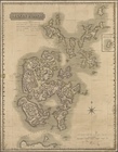
Orkney Islands
use:
… partner (e.
g
., New York
Map of the Battlefield of Ant…
use:
… partner (e.
g
., New York
Chart of Long Island Sound, 1…
use:
… partner (e.
g
., New York
Chart of the entrance to Ches…
use:
… partner (e.
g
., New York
Entrance to New York Bay from…
use:
… partner (e.
g
., New York
Nautical chart of Little Egg …
use:
… partner (e.
g
., New York
The Bay and river of Delaware
use:
… partner (e.
g
., New York
State of Florida: compiled fr…
use:
… partner (e.
g
., New York
Long Island Sound from New Yo…
use:
… partner (e.
g
., New York
Long Island Sound from New Yo…
use:
… partner (e.
g
., New York
m
Colton's new sectional map of…
use:
… partner (e.
g
., New York
Map of the state of South Car…
use:
… partner (e.
g
., New York
End of results
|
Top