Click to visit the main New York Public Library Homepage
The New York Public Library
Digital Collections
About Digital Collections
Browse
Search only public domain materials
Items
Collections
Divisions
Home
Search
Browse
About
Search only public domain materials
Items
Collections
Divisions
Digital Collections
Using Images
Using Data
Search
Filtered keyword search
Show filters
Hide filters
Show Only Public Domain
topic
Administrative and political divisions
35
Railroads
24
Real property
18
Landowners
10
Parks
9
More
Less
name
Rand McNally and Company
12
World's Columbian Exposition (1893 : Chicago, Ill.)
7
Blanchard, Rufus, 1821-1904
6
United States. Surveyor General of Illinois and Missouri
6
Messinger, John, 1771-1846
5
More
Less
collection
Maps of North America
126
Illinois at Vicksburg: pub. under authority of an act of the forty-fifth General assembly by the Illinois-Vicksburg military park commission
2
Atlases, gazetteers, guidebooks and other books
1
Wallach Division Picture Collection
1
place
Illinois
89
Chicago (Ill.)
47
Chicago
35
Missouri
17
Indiana
13
More
Less
genre
x
Maps
Cadastral maps
18
Geological maps
5
Aerial views
3
Geological cross-sections
3
More
Less
publisher
publisher not identified
15
Government Printing Office
5
Rufus Blanchard
4
Rand McNally & Co
3
Rand, McNally & Co
3
More
Less
division
Map Division
127
Milstein Division
2
Wallach Division: Picture Collection
1
type
cartographic
129
still image
5
text
2
Date Range
to
130 results found for:
x
illinois
Filtering on:
x
Genre
: Maps
Sort by:
Relevance
Title
Date created
Date digitized
Sequence
Johnson's
Illinois
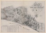
Map of the new line of defenc…
collection:
Illinois
Illinois
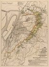
Map of the Vicksburg national…
collection:
Illinois
Illinois
& Missouri
G, diagram of the state of
Illinois
…
note:
… of
Illinois
and Missouri."…
Railroad map of
Illinois
, 1891 …
abstract:
…. Probably from:
Illinois
Rand, McNally & Co.'s
Illinois
…
abstract:
… and shippers' guide of
Illinois
Springfield, Ill. 1892
collection:
Illinois
Diagram of the state of
Illinois
…
note:
… for the District of
Illinois
Railroad map of
Illinois
, 1894-5 …
abstract:
… detached from:
Illinois
Map of
Illinois
with parts of Indiana
…,
Illinois
… of southern
Illinois
bordering
abstract:
… limestone, near the
Illinois
A new map of
Illinois
and part
note:
… of the District Court of
Illinois
."…
… and
Illinois
, between
Ottawa,
Illinois
, 1898 …
… of
Illinois
…
abstract:
… of
Illinois
" and "Progressive
Railway guide for
Illinois
…
No. 1, diagram of coal measur…
collection:
… County,
Illinois
Map showing the boulevards an…
collection:
Illinois
… of
Illinois
and Indiana] …
Topographical map of lands be…
collection:
Illinois
Hyde Park : [Chicago, Illinoi…
collection:
Illinois
… in the
Illinois
Country, with part
m
…,
Illinois
…
State of
Illinois
…
Map showing the boulevards an…
collection:
Illinois
Snyder's real estate map of t…
collection:
… County,
Illinois
and Lake
Chicago : with the school sec…
collection:
Illinois
State of
Illinois
…
Map of Chicago and vicinity
collection:
Illinois
General plan of Riverside : […
collection:
Illinois
Map showing the boulevards an…
collection:
Illinois
Map of the city of Nauvoo : d…
note:
… of
Illinois
."…
m
Map of Cook County,
Illinois
…
abstract:
… of the State of
Illinois
New sectional map of the state of
Illinois
…
New sectional map of the state of
Illinois
…
m
The Union News Company's new …
collection:
Illinois
Map of South Waukegan showing…
collection:
Illinois
Map of Jackson Park : showing…
collection:
Illinois
… Island County,
Illinois
New sectional map of the state of
Illinois
Map showing the boulevards an…
collection:
Illinois
Chicago : correctly copied fr…
collection:
Illinois
Map showing the boulevards an…
collection:
Illinois
The states of Ohio, Indiana &
Illinois
note:
…,
Illinois
and the Michigan
Map of Chicago showing water …
collection:
Illinois
…, and
Illinois
…
abstract:
…, Wisconsin, and
Illinois
Shelton & Kensett's map of th…
note:
… the surveys of the
Illinois