Click to visit the main New York Public Library Homepage
The New York Public Library
Digital Collections
About Digital Collections
Browse
Search only public domain materials
Items
Collections
Divisions
Home
Search
Browse
About
Search only public domain materials
Items
Collections
Divisions
Digital Collections
Using Images
Using Data
Search
Filtered keyword search
Show filters
Hide filters
Show Only Public Domain
topic
Nautical charts
218
Harbors
48
Coasts
34
Navigation
28
Rivers
8
More
Less
name
Thornton, Samuel
173
United States Coast Survey
169
Bache, A. D. (Alexander Dallas), 1806-1867
147
Mathiot, G
37
Alden, James, 1810-1877
30
More
Less
collection
Maps of North America
207
Atlases, gazetteers, guidebooks and other books
174
Maps of New York City and State
12
Naval air pilot. West Indies including Bermuda, Bahama islands, the north coast of Colombia and Venezuela. Corrected to July 1, 1940. Notice to aviators, no. 7, 1940
2
Exposé des travaux relatifs à la reconnaissance hydrographique des côtes, occidentales de France
1
More
Less
place
Atlantic Ocean
34
Massachusetts
25
California
24
Florida
23
Virginia
21
More
Less
genre
x
Nautical charts
Maps
397
Bathymetric maps
97
Illustrations
2
Prints
2
More
Less
publisher
U.S. Coast Survey
86
U.S. Coast Survey Office
46
United States Coast Survey
20
publisher not identified
9
Coast Survey Office
5
More
Less
division
Map Division
394
General Research Division
3
type
cartographic
397
still image
7
text
2
Date Range
to
397 results found for:
x
New York Maps
Filtering on:
x
Genre
: Nautical charts
Sort by:
Relevance
Title
Date created
Date digitized
Sequence
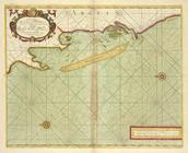
Carta particolare della nuoua…
use:
… partner (e.g.,
New
York
Survey of the mouth of Clinto…
use:
… partner (e.g.,
New
York
Nantucket Sound: western part
use:
… partner (e.g.,
New
York
Preliminary chart of Calibogu…
use:
… partner (e.g.,
New
York
m
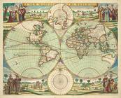
No va & accuratissima totius …
use:
… partner (e.g.,
New
York
A
new
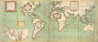
and correct Mapp of the WORLD
use:
… partner (e.g.,
New
York
1889, Larchmont Harbor, N.Y.:…
use:
… partner (e.g.,
New
York
Preliminary chart of Hampton …
use:
… partner (e.g.,
New
York
Map
of parts
use:
… partner (e.g.,
New
York
Atlantic Coast, Chesapeake en…
use:
… partner (e.g.,
New
York
Coast chart no. 48, Cape Fear…
use:
… partner (e.g.,
New
York
Sketch of the coast of North …
use:
… partner (e.g.,
New
York
A
new
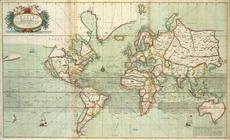
mapp of the world.
use:
… partner (e.g.,
New
York
A chart of the shoulds and ri…
use:
… partner (e.g.,
New
York
Harbor of Michigan City, Indi…
use:
… partner (e.g.,
New
York
A
new
chart of the sea coast of ARGUIN
use:
… partner (e.g.,
New
York
Reconnaissance of Hatteras In…
use:
… partner (e.g.,
New
York
Reconnaissance of the entranc…
use:
… partner (e.g.,
New
York
Tybee Bay and Calibogue Sound…
use:
… partner (e.g.,
New
York
Chart of a part of the Gulf o…
use:
… partner (e.g.,
New
York
Survey of the entrance to Mil…
use:
… partner (e.g.,
New
York
City and harbor of Portland, …
use:
… partner (e.g.,
New
York
Preliminary survey of Humbold…
use:
… partner (e.g.,
New
York
Charleston harbour, S. Ca. : …
use:
… partner (e.g.,
New
York
Map
of the mouth of Great Sodus Bay
use:
… partner (e.g.,
New
York
Ocilla River, Florida
use:
… partner (e.g.,
New
York
Sketch of Ocracoke Inlet, Nor…
use:
… partner (e.g.,
New
York
Preliminary chart of Frying P…
use:
… partner (e.g.,
New
York
Reconnoissance of Cape Canave…
use:
… partner (e.g.,
New
York
Hydrographic reconnaissance o…
use:
… partner (e.g.,
New
York
Plan of the bay and island of…
use:
… partner (e.g.,
New
York
Preliminary survey of San Ped…
use:
… partner (e.g.,
New
York
m
Map
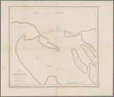
of the portion of the Connecticut River between
use:
… partner (e.g.,
New
York
Preliminary chart of Hatteras…
use:
… partner (e.g.,
New
York
Preliminary sketch of Cherrys…
use:
… partner (e.g.,
New
York
St. Helena Sound, South Carol…
use:
… partner (e.g.,
New
York
Reconnaissance of Doboy Bar a…
use:
… partner (e.g.,
New
York
Preliminary chart of the sea …
use:
… partner (e.g.,
New
York
Map
of comparison of Maffitt's Channel
use:
… partner (e.g.,
New
York
Map
of the coast of Massachusetts and Rhode Island
use:
… partner (e.g.,
New
York
Unfinished proof of Narragans…
use:
… partner (e.g.,
New
York
Preliminary chart of Stellwag…
use:
… partner (e.g.,
New
York
Norfolk harbor, Virginia : fr…
use:
… partner (e.g.,
New
York
Preliminary survey of Turtle …
use:
… partner (e.g.,
New
York
Stono Inlet, South Carolina
use:
… partner (e.g.,
New
York
Reconnaissance of Tampa Bay, …
use:
… partner (e.g.,
New
York
Reconnaissance of Coffin's Pa…
use:
… partner (e.g.,
New
York
m
Preliminary chart of Port Roy…
use:
… partner (e.g.,
New
York
Savannah River, reconnaissanc…
use:
… partner (e.g.,
New
York
Preliminary chart of Bull's B…
use:
… partner (e.g.,
New
York
1
2
Previous
Next
1
2
Previous
Next