Click to visit the main New York Public Library Homepage
The New York Public Library
Digital Collections
About Digital Collections
Browse
Search only public domain materials
Items
Collections
Divisions
Home
Search
Browse
About
Search only public domain materials
Items
Collections
Divisions
Digital Collections
Using Images
Using Data
Search
Filtered keyword search
Show filters
Hide filters
Show Only Public Domain
topic
Africa, West
1
Description and travel
1
Islands
1
Le Maire Strait (Argentina)
1
name
Astley, Thomas, -1839
2
Blaeu, Willem Janszoon, 1571-1638
2
Denham, Dixon, 1786-1828
2
Green, John, fl. 1730-1753
2
J. & C. Walker (Firm)
2
More
Less
collection
I. N. Phelps Stokes Collection of American Historical Prints
5
A new general collection of voyages and travels: consisting of the most esteemed relations, which have been hitherto published in any language; comprehending everything remarkable in its kind, in Europe, Asia, Africa, and America
2
Narrative of travels and discoveries in Northern and Central Africa, in the years 1822, 1823, and 1824. Vol I & II
2
A new and accurate description of the coast of Guinea, divided into the Gold, the Slave, and the Ivory coasts
1
place
Africa, West
4
Africa
3
America
3
Atlantic Coast (Africa, West)
2
Europe
2
More
Less
genre
x
Prints
Maps
8
Books
2
Illustrations
1
Plans
1
More
Less
publisher
John Murray
2
Printed for T. Astley
2
Iohannus van Kuelen
1
J. Knapton [etc.]
1
division
Wallach Division: Print Collection
5
Schomburg Manuscripts, Archives and Rare Books Division
3
Rare Book Division
2
type
cartographic
8
still image
2
Date Range
to
10 results found for:
x
West Africa Maps
Filtering on:
x
Genre
: Prints
Sort by:
Relevance
Title
Date created
Date digitized
Sequence
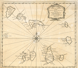
Insula S. Thomae [
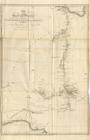
West
Africa
]
A
map
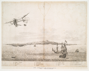
or chart of the Cape de Verde Islands.
collection:
…, in Europe, Asia,
Africa
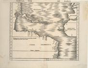
Tabula Terre Nove
topic:
Africa
,
West
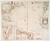
Paskaart van Guinea, Brasilie…
collection:
… and
maps
in the Stokes
West
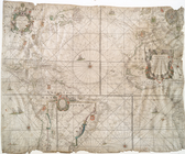
-Indische paskaert....
note:
… of the
West
India Company
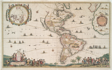
America.
note:
… and earlier
maps
as a penisula
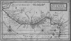
A New and Exact
Map
of Guinea Divided
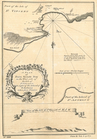
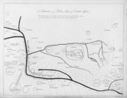
A plan of Porto Grande Bay on the
west
… & Central
Africa
, by Dr
collection:
[
Map
of regions in North and
West
Africa
… of Bello's
map
of Central
Africa
.