Click to visit the main New York Public Library Homepage
The New York Public Library
Digital Collections
About Digital Collections
Browse
Search only public domain materials
Items
Collections
Divisions
Home
Search
Browse
About
Search only public domain materials
Items
Collections
Divisions
Digital Collections
Using Images
Using Data
Search
Filtered keyword search
Show filters
Hide filters
Show Only Public Domain
topic
Discovery and exploration
9
Real property
8
Administrative and political divisions
7
Parks
7
Railroads
6
More
Less
name
Austro-Hungarian Monarchy. Militärgeographisches Institut
773
Geological Survey (U.S.)
41
Julius Bien & Co
32
New York (N.Y.). Department of Parks. Topographical Division
29
Bien, Julius, 1826-1909
22
More
Less
collection
Spezialkarte der Osterreichisch-Ungarischen Monarchie
773
Atlases of New York City
120
Maps of North America
113
Maps of New York City and State
28
Atlases of the United States
15
More
Less
place
Staten Island (New York, N.Y.)
90
Central Park (New York, N.Y.)
29
New York (State)
25
New York (N.Y.)
22
New York Metropolitan Area
22
More
Less
genre
x
Topographic maps
Maps
1062
Atlases
15
Cadastral maps
6
Bathymetric maps
4
More
Less
publisher
K.u.K. Militargeographisches Institut
773
The Division
29
U.S. Geological Survey
22
Julius Bien & Co
15
Impr. impériale
10
More
Less
division
Map Division
1050
Rare Book Division
11
General Research Division
1
type
cartographic
1062
text
3
still image
2
Date Range
to
Looking for this collection?
Spezialkarte der Osterreichisch-Ungarischen Monarchie
774 items
1,062 results found for:
x
Maps
Filtering on:
x
Genre
: Topographic maps
Sort by:
Relevance
Title
Date created
Date digitized
Sequence
Cessières
abstract:
World War 1, French Trench
Map
Set, Cessieres
m
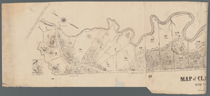
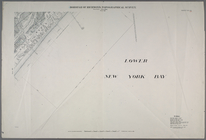
Map
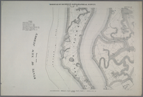
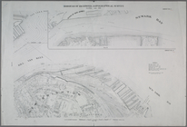
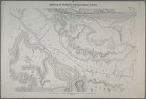
of Clasons Point
note:
Mapping
the Nation (NEH grant, 2015-2018)…
United States contour
map
note:
Mapping
the Nation (NEH grant, 2015-2018)…
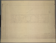
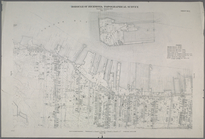
Richmond Borough: Index to Li…
m
Topographical
map
M-T-10-100: Index
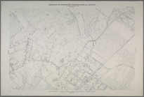
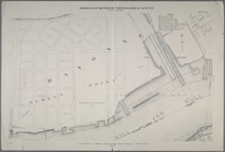
Map
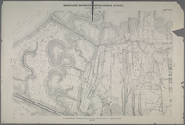
of Central Park
note:
Each
map
includes
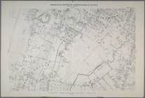
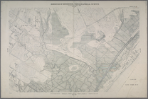
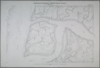
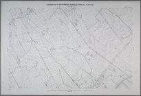
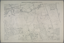
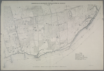
Sheet No. 6. [Includes Hollan…
Sheet No. 7.[Includes Shooter…
Sheet No. 11. [Includes New B…
Sheet No. 15. [Includes Port …
Sheet No. 16. [Includes West …
Sheet No. 18. [Includes Gryme…
Sheet No. 20. [Includes Lambe…
Sheet No. 25. [Includes Gryme…
Sheet No. 27. [Includes Prall…
Sheet No. 28. [Includes Bloom…
Sheet No. 29. [Includes Bulls…
Sheet No. 31. [Includes Castl…
Sheet No. 32. [Includes Gryme…
Sheet No. 33. [Includes Conco…
Sheet No. 37. [Includes Rockl…
Sheet No. 38. [Includes Port …
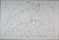
Sheet No. 43. [Includes Wild …
Sheet No. 44. [Includes Linol…
Sheet No. 45. [Includes New S…
Sheet No. 46. [Includes Rockl…
Sheet No. 47.[includes Egbert…
Sheet No. 49. [Includes Linde…
Sheet No. 50. [Includes South…
Sheet No. 51 [Includes Island…
Sheet No. 55. [Includes (Egbe…
Sheet No. 58. [Includes Bened…
Sheet No. 60. [Includes Bridg…
Sheet No. 69. [Includes Dewey…
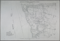
Sheet No. 71. [Includes Oakwo…
Sheet No. 74. [Includes Rossv…
Sheet No. 81. [Includes Sharr…
Sheet No. 82. [Includes Sharr…
Sheet No. 84. [Includes Annad…
Sheet No. 85. [Includes (Gree…
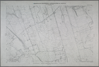
Sheet No. 94. [Includes Richm…
Sheet Nos. 99 & 100.[Include …
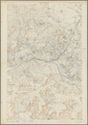
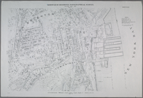
Relief
map
of New York and vicinity
note:
…
map
.
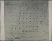
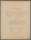
List of Plates and References
collection:
… in a series of
maps
Sheet Nos. 1 & 4. [Sheet No. …
Sheet No. 2. [Includes Richmo…
Sheet No. 8. [Includes New Yo…
Sheet No. 9. [Includes Bennet…
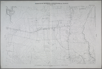
Sheet No. 13. [Includes Old P…
Sheet No. 14. [Includes Marin…
1
2
3
4
5
Previous
Next
1
2
3
4
5
Previous
Next