Click to visit the main New York Public Library Homepage
The New York Public Library
Digital Collections
About Digital Collections
Browse
Search only public domain materials
Items
Collections
Divisions
Home
Search
Browse
About
Search only public domain materials
Items
Collections
Divisions
Digital Collections
Using Images
Using Data
Search
Filtered keyword search
Show filters
Hide filters
Show Only Public Domain
topic
Discovery and exploration
9
Administrative and political divisions
4
Indian reservations
4
Surveys
4
Forests and forestry
3
More
Less
name
Geological Survey (U.S.)
36
Gannett, Henry, 1846-1914
16
Walcott, Charles D. (Charles Doolittle), 1850-1927
16
Julius Bien & Co
11
United States. Congress (55th, 3rd session : 1898-1899)
9
More
Less
collection
Maps of North America
66
Maps of New York City and State
3
place
United States
10
Alaska
9
Washington (State)
7
Colorado
5
Washington (D.C.)
5
More
Less
genre
x
Topographic maps
Maps
69
Bathymetric maps
4
Diagrams
1
Geological maps
1
More
Less
publisher
U.S. Geological Survey
22
U.S. Congress
9
Northern Transcontinental Survey?
6
The Commission
3
U.S. Coast and Geodetic Survey
2
More
Less
division
Map Division
69
type
cartographic
69
still image
1
text
1
Date Range
to
69 results found for:
x
Washington (State)
Filtering on:
x
Genre
: Topographic maps
Sort by:
Relevance
Title
Date created
Date digitized
Sequence
… Region,
Washington
Ter. …
m
… region,
Washington
Ter. …
Map of
Washington
Territory
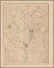
Map of Yakima Region,
Washington
Ter. …
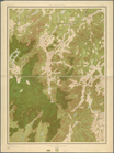
Forest map of the Yakima Region,
Washington
Map of Yakima Region,
Washington
Ter. …
Map of Colville Region,
Washington
Ter. …
The Louisiana
State
University topographical map
note:
Prime meridians: Greenwich and
Washington
m
… of the
state
of Colorado …
note:
… of Congress at
Washington
, D.C
m
New York City and vicinity
collection:
Maps of New York City and
State
m
Map of Connecticut
note:
… in co-operation with the
State
… of the
state
of Colorado …
note:
… of Congress at
Washington
."…
Albany and vicinity
note:
… by N.Y.
State
Survey
m
Map of Connecticut
note:
… in co-operation with the
State
m
Map of Connecticut
note:
… in co-operation with the
State
Map of the city of
Washington
showing present
Land classification map, New …
note:
… in cooperation with the
State
A map of the extremity of Cap…
note:
… Engineers,
Washington
m
… of
Washington
…
Washington
and vicinity, Maryland-District
m
… of the city of
Washington
made
m
Topographical map of the Dist…
note:
…"Engraved by D. McClelland,
Washington
, D.C."…
Topographical map of the Dist…
collection:
Washington
, D.C.
Mt.
Washington
and vicinity
m
Topographical map of the
state
of New Jersey
note:
Prime meridians: Greenwich and
Washington
Topographical map of the
state
of New Jersey
note:
Prime meridians: Greenwich and
Washington
… of the Southern
States
note:
Prime meridians: Greenwich and
Washington
.
… of the Potomac to
Washington
City
m
Massachusetts
note:
… of the United
State
United
States
contour map
United
States
contour map
United
States
relief map
Philadelphia and vicinity : P…
abstract:
Shows
state
and county boundaries
The Hawaiian Islands: compile…
note:
….,
Washington
, D.C."--Lower
m
United
States
Hypsometric map of the United
States
note:
… for the continental United
States
: 47
states
and territories
Hawaiian or Sandwich Islands
collection:
States
m
United
States
Narraganset Bay: [Rhode Islan…
collection:
States
m
Central Virginia
collection:
States
Montana Fort Logan sheet
collection:
States
New Haven, Connecticut
note:
… by the United
States
Coast
Topographic sheet, Montana (S…
collection:
States
Plan of Lovejoy's narrows fro…
collection:
States
Alaska : Fortymile quadrangle
collection:
States
Illinois--Missouri, St. Louis…
collection:
States
Montana Helena sheet
collection:
States
New Jersey (Sussex County) Fr…
collection:
States
Yellowstone National Park
collection:
States
Detailed map of part of Canyo…
collection:
States