Click to visit the main New York Public Library Homepage
The New York Public Library
Digital Collections
About Digital Collections
Browse
Search only public domain materials
Items
Collections
Divisions
Home
Search
Browse
About
Search only public domain materials
Items
Collections
Divisions
Digital Collections
Using Images
Using Data
Search
Filtered search
Show filters
Hide filters
Show Only Public Domain
topic
Real property
160
Landowners
117
Administrative and political divisions
34
Railroads
18
Cities and towns
10
More
Less
name
Smith, Robert Pearsall, 1827-1898
16
Dripps, M. (Matthew)
8
French, J. H. (John Homer), 1824-1888
6
J.B. Beers & Co
6
Welcke, Robert A
5
More
Less
collection
x
Maps of New York City and State
place
New York (State)
179
New York
35
New York (N.Y.)
24
Yonkers (N.Y.)
18
Manhattan (New York, N.Y.)
16
More
Less
genre
x
Cadastral maps
Maps
183
Manuscript maps
16
Topographic maps
4
Bathymetric maps
2
More
Less
publisher
publisher not identified
33
J.B. Beers & Co
6
M. Dripps
5
J.H. French
4
Common Council
3
More
Less
division
Map Division
183
type
cartographic
182
still image
4
text
1
Date Range
to
183 results found
Filtering on:
x
Genre
: Cadastral maps
x
Rights
: Public Domain
x
Collection
: Maps of New York City and State
For more collection details, visit the
Maps of New York City and State collection page
.
Sort by:
Title
Date created
Date digitized
Sequence
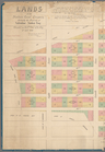
Tracts and farms with street …
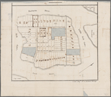
Block sketch 1679, New York C…
m
Map of the borough of Queens,…
m
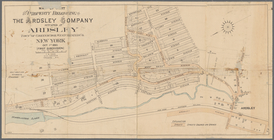
Peremptory sale of a suburban…
Flushing
Block no. 86 : confidential r…
Livingston Heights : Livingto…
m
Lands of the Harlaem Canal Co…
m
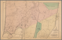
Map of the southern part of W…
m
Map of Ulster County, New York
m
Map of Washington County, New…
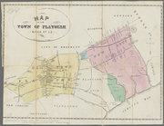
Map of the town of Flatbush, …
m
Map of Dutchess Co., New York…
m
Map of Kings and part of Quee…
m
Map of Albany County, New Yor…
Map of Great Barn Island, New…
m
Map of the city of Williamsbu…
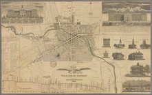
Map of the village of Auburn
m
Map of Dunkirk
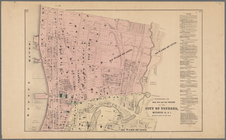
Map of the city of Yonkers, F…
Map of the city of Yonkers, S…
m
Map of the property of the Yo…
Southern part of Yonkers, and…
Plan of the Country Club Land…
Map of the city of Buffalo
A new map of the city of Buff…
m
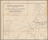
Village of New-Rochelle, New-…
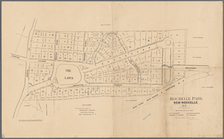
Rochelle Park, New-Rochelle, …
M[ap of par]t of the property…
Map of the upper part of the …
Map of the flats above Albany
A plan of the Manor of Philip…
m
Asher & Adams' new topographi…
Map of pr[op]erty of Union Av…
Map of the village of Lyon Mo…
The Meadows: to be offered at…
Map of property at Van Buren …
Map of the town of Waterloo, …
Map of the village of Waterto…
Town & village of Seneca Fall…
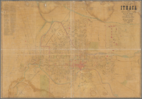
Map of City of Ithaca, N.Y.: …
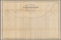
Map of Ogdensburgh
Plan of an extension of the v…
Plan of the easterly part of …
Town of Greenburgh: Westchest…
Portions of 2nd, 3rd, and 4th…
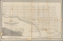
Map of Schuylerville: exhibit…
Atherton, St. Lawrence County…
Map showing location of lands…
Map of land belonging to Feli…