Click to visit the main New York Public Library Homepage
The New York Public Library
Digital Collections
About Digital Collections
Browse
Search only public domain materials
Items
Collections
Divisions
Home
Search
Browse
About
Search only public domain materials
Items
Collections
Divisions
Digital Collections
Using Images
Using Data
Search
Filtered search
Show filters
Hide filters
Show Only Public Domain
name
x
Fry, Joshua, approximately 1700-1754
Jefferson, Peter, 1708-1757
5
Robert de Vaugondy, Gilles, 1688-1766
2
Sayer, Robert, 1725-1794
2
Groux, Charles Jacques
1
More
Less
collection
Lawrence H. Slaughter Collection of English maps, charts, globes, books and atlases
2
Maps of North America
2
John H. Levine Collection
1
place
x
Early works to 1800
Maps
5
Maryland
5
Middle Atlantic States
5
Virginia
5
More
Less
genre
Maps
5
publisher
Chez Delamarche?,
1
Chéz Le Rouge, ing? géographe du Roi, Rue des Grands Augustins
1
Printed for Robt. Sayer at No. 53 in Fleet Street, & Thos. Jefferys at the corner of St. Martins Lane, Charing Cross
1
Printed for Robt. Sayer, at No. 53 in Fleet Street
1
s.n.,
1
division
Map Division
5
type
cartographic
5
Date Range
to
5 results found
Filtering on:
x
Place
: Early works to 1800
x
Name
: Fry, Joshua, approximately 1700-1754
Sort by:
Title
Date created
Date digitized
Sequence
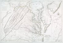
Carte de la Virginie et du Ma…
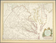
Virginie, Maryland : en 2 feu…
A map of the most inhabited p…
m
A map of the most inhabited p…
Carte de la Virginie et du Ma…