Click to visit the main New York Public Library Homepage
The New York Public Library
Digital Collections
About Digital Collections
Browse
Search only public domain materials
Items
Collections
Divisions
Home
Search
Browse
About
Search only public domain materials
Items
Collections
Divisions
Digital Collections
Using Images
Using Data
Search
Filtered search
Show filters
Hide filters
Show Only Public Domain
topic
Nautical charts
2
name
Faden, William, 1749-1836
1
Hills, John, surveyor
1
Robert Sayer and John Bennett (Firm)
1
collection
x
Maps of New York City and State
place
x
Lower Bay (N.Y. and N.J.)
Hudson River Estuary (N.Y. and N.J.)
1
Lower Bay (N.Y. and N.J.) -- Maps -- Early works to 1800
1
New Jersey
1
New York (N.Y.)
1
More
Less
genre
Maps
2
publisher
Printed for Robt. Sayer & John Bennett, sea chart & map-sellers ..
1
Published by Wm. Faden, geographer to the King, Charing-Cross
1
division
Map Division
2
type
cartographic
2
Date Range
to
2 results found
Filtering on:
x
Place
: Lower Bay (N.Y. and N.J.)
x
Collection
: Maps of New York City and State
For more collection details, visit the
Maps of New York City and State collection page
.
Sort by:
Title
Date created
Date digitized
Sequence
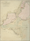
A chart of the bar of Sandy H…
Chart of the entrance of Huds…