Click to visit the main New York Public Library Homepage
The New York Public Library
Digital Collections
About Digital Collections
Browse
Search only public domain materials
Items
Collections
Divisions
Home
Search
Browse
About
Search only public domain materials
Items
Collections
Divisions
Digital Collections
Using Images
Using Data
Search
Filtered search
Show filters
Hide filters
Show Only Public Domain
topic
Railroads
9
Administrative and political divisions
7
Telephone lines
6
Geological surveys
5
Mines and mineral resources
5
More
Less
name
Watkins, Carleton E., 1829-1916
9
United States. Farm Security Administration
7
Rothstein, Arthur, 1915-1985
6
Thomas Houseworth & Co
6
O'Sullivan, Timothy H., 1840-1882
5
More
Less
collection
Robert N. Dennis collection of stereoscopic views
29
Maps of North America
24
Farm Security Administration Photographs
7
"The Pageant of America" Collection
6
Photographic views of the United States
5
More
Less
place
x
Nevada
California
20
United States
11
Tahoe, Lake (Calif. and Nev.)
6
Utah
6
More
Less
genre
Photographs
52
Stereographs
29
Maps
24
Prints
3
Geological cross-sections
2
More
Less
publisher
Govt. Print. Off
3
s.n
2
Published by Warren Holt
2
War Dept., U.S. Pacific Rail Road Explorations & Surveys
2
Daily evening post (San Francisco, Calif.)
1
More
Less
division
Wallach Division: Photography Collection
47
Map Division
24
Milstein Division
5
Wallach Division: Picture Collection
3
type
still image
57
cartographic
24
Date Range
to
79 results found
Filtering on:
x
Place
: Nevada
Sort by:
Title
Date created
Date digitized
Sequence
m
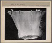
Boulder Dam. Nevada
m
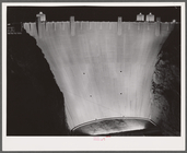
Boulder Dam. Nevada
m
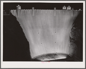
Boulder Dam. Nevada
m
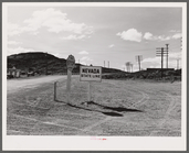
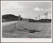
State line. Utah--Nevada
m
State line. Utah--Nevada
m
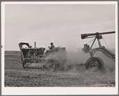
Indian leveling land. Nevada
m
Topographical map of central …
m
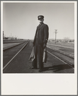
Brakeman on the Challenger. N…
A new map of the states of Ca…
Map of California : to accomp…
Outline map of Washoe Distric…
The North End Mines : field …
Topographical map showing the…
Map of the Lower Comstock and…
Reduced map of the state of C…
Geological section of the Coa…
Geological section of the Ber…
Map of wagon routes in Utah T…
Map of the states of Californ…
Post route map of the states …
Map of the states of Californ…
Bancroft's map of California,…
Karte von Californien und The…
County and township map of Ut…
State of Nevada
State of Nevada
Itineraire aux mines de la Ne…
Official railroad map of the …
Nevada [Basin]: [shaded relie…
Map showing detailed topograp…
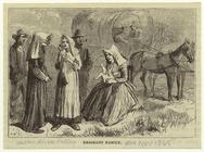
Emigrant family
m
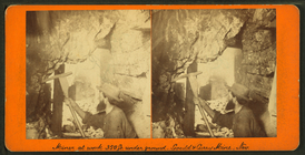
Miner at work, 350 ft. underg…
m
View of Carson from the west.
m
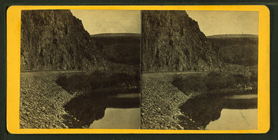
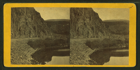
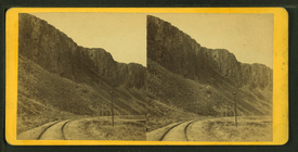
Palisades on the Humboldt riv…
m
Views along the Palisades of …
m
Palisades bluff, 2000 feet hi…
m
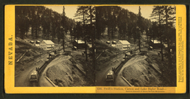
Swift's station, Carson and E…
m
Carson City and valley--from …
m
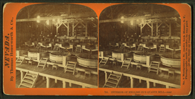
Interior of English Co.'s qua…
m
Gould & Curry mill and works-…
m
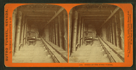
Inside the Sutro Tunnel.
m
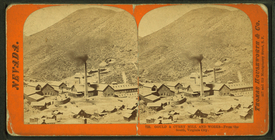
A mining camp nestled in the …
m
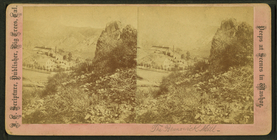
The Brunswick hill.
m
Bacon, Trench, and Kelsey mil…
m
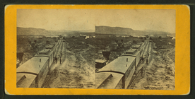
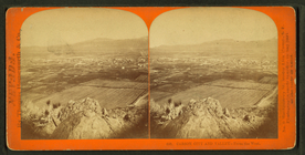
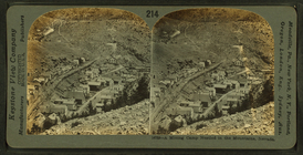
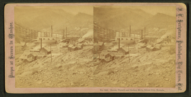
Panorama of Virginia City.
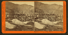
m
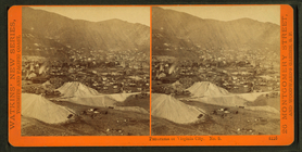
Panorama at Virginia City.
m
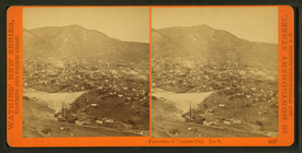
Panorama of Virginia City.
m
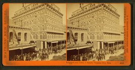
International Hotel, C street…
m
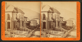
Residence in Virginia City.
m
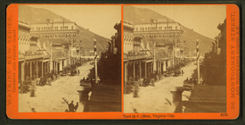
View in C street, Virginia Ci…