Click to visit the main New York Public Library Homepage
The New York Public Library
Digital Collections
About Digital Collections
Browse
Search only public domain materials
Items
Collections
Divisions
Home
Search
Browse
About
Search only public domain materials
Items
Collections
Divisions
Digital Collections
Using Images
Using Data
Search
Filtered search
Show filters
Hide filters
Show Only Public Domain
topic
x
Real property
Fire insurance
5198
Cities & towns
5007
Business enterprises
468
Landowners
262
More
Less
name
Sanborn Map Company
5093
G.W. Bromley & Co
2125
Ullitz, Hugo
606
E.B. Hyde & Co
545
E. Belcher Hyde Map Company
488
More
Less
collection
Atlases of New York City
8354
Atlases of the United States
1677
Maps of New York City and State
296
Collection of broadside real estate maps announcing auctions of lots in early 19th century New York City
67
Photographic views of New York City, 1870's-1970's, from the collections of the New York Public Library
23
More
Less
place
x
New York (State)
New York
3149
Manhattan (New York, N.Y.)
1973
Brooklyn (New York, N.Y.)
812
New York (N.Y.)
787
More
Less
genre
Maps
10094
Atlases
1677
Cadastral maps
227
Indexes
126
Title pages
79
More
Less
publisher
Sanborn Map Company
5009
G.W. Bromley & Co
1997
E. Belcher Hyde
425
E. Robinson Co
246
F. W. Beers & Co
148
More
Less
division
Map Division
10267
Milstein Division
23
Manuscripts and Archives Division
20
No Division
1
type
cartographic
10172
text
337
still image
49
Date Range
to
10,441 results found
Filtering on:
x
Place
: New York (State)
x
Topic
: Real property
Sort by:
Title
Date created
Date digitized
Sequence
Results 251 - 300
m
Manhattan: 10th Avenue - 213t…
m
Manhattan: 10th Avenue - 214t…
m
Manhattan: Madison Avenue - 9…
m
Queens: Corona Avenue - 102nd…
m
Queens: Jamaica Avenue - 144t…
m
Queens: Kissena Boulevard - P…
m
Queens: Kissena Boulevard - 6…
m
Queens: 152nd Street - Quince…
m
Queens: Kissena Boulevard - N…
m
Queens: North Hempstead Turn …
m
Queens: Queens Boulevard - 86…
m
Queens: Springfield Boulevard…
m
Richmond: Amboy Road - Arden …
m
Richmond: Arthur Kill Road - …
m
Richmond: Arthur Kill Road - …
m
Richmond: Arthur Kill Road - …
m
Richmond: Arthur Kill Road - …
m
Richmond: Clove Road - Beverl…
m
Richmond: Elizabeth Avenue - …
m
Richmond: Manor Road - Kent A…
m
Map of Waverly Park lots loca…
Village of Port Ontario, in t…
Tuxedo Park, Orange Co., New …
Map of the village of Rochest…
Shonnard Park at Yonkers, est…
Map of part of the village of…
m
Map of Oswego, Oswego Co., N.…
Map of Getty Square, Yonkers:…
m
Map of the town of Morrisania…
m
Map of Geneva, Ontario Co., N…
Map of the town of Niagara
Williams' map of the City of …
m
Huguenot Park, Westchester Co…
Map of the Cities of Albany a…
Map of Olean, New York
m
Upper Nyack
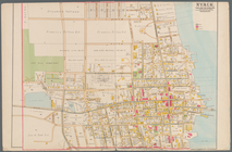
Map of Albany, New York
Map of Highbridgeville in the…
Town of Greenburgh, Westchest…
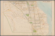
South Nyack
Nyack
Map of Webster's Addition to …
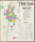
Insurance maps of Tarrytown, …
Insurance maps of Tarrytown, …
Plan of the city of Albany ab…
Map of property belonging to …
Map of the city of Yonkers, T…
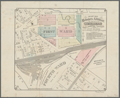
Part of Wards 3 & 4, Yonkers
Map of lots situated in the c…
Map of Westminster Park of th…
1
2
3
4
5
6
7
8
9
10
…
41
42
Previous
Next
1
2
3
4
5
6
7
8
9
10
…
41
42
Previous
Next