Click to visit the main New York Public Library Homepage
The New York Public Library
Digital Collections
About Digital Collections
Browse
Search only public domain materials
Items
Collections
Divisions
Home
Search
Browse
About
Search only public domain materials
Items
Collections
Divisions
Digital Collections
Using Images
Using Data
Search
Filtered search
Show filters
Hide filters
Show Only Public Domain
topic
Guidebooks
2
Distances, etc
1
Guidebooks, 1802
1
Roads
1
name
Tanner, Henry Schenck, 1786-1858
5
Drayton, Joseph
2
Allen, William
1
Atwood, John M., approximately 1818-
1
Carey & Hart
1
More
Less
collection
Maps of North America
8
Atlases of the United States
3
Lawrence H. Slaughter Collection of English maps, charts, globes, books and atlases
1
place
x
Philadelphia (Pa.) -- Maps
Philadelphia (Pa.) -- Administrative and political divisions -- Maps
3
United States
2
Middle Atlantic States
1
Middle Atlantic States Guidebooks
1
More
Less
genre
Maps
12
publisher
Henry Schenck Tanner
2
C.P. Harrison,
1
Ecksteinska tryckeriet?,
1
M. Carey
1
Published by ... J. Doggett, Jr., 89 Nassau St.,
1
More
Less
division
Map Division
12
type
x
cartographic
Date Range
to
12 results found
Filtering on:
x
Place
: Philadelphia (Pa.) -- Maps
x
Type
: cartographic
Sort by:
Title
Date created
Date digitized
Sequence
Philadelphia and the commence…
Philadelphia and environs.
Philadelphia and environs.
Philadelphia and environs.
Plan of the city of Philadelp…
Plan of the city of Philadelp…
To the citizens of Philadelph…
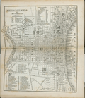
Philadelphia
Plan af Philadelphia
Plan of the city of Philadelp…
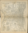
Philadelphia.
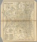
Philadelphia
End of results
|
Top