Click to visit the main New York Public Library Homepage
The New York Public Library
Digital Collections
About Digital Collections
Browse
Search only public domain materials
Items
Collections
Divisions
Home
Search
Browse
About
Search only public domain materials
Items
Collections
Divisions
Digital Collections
Using Images
Using Data
Search
Filtered search
Show filters
Hide filters
Show Only Public Domain
topic
Real property
69
Local transit
9
Landowners
8
Administrative and political divisions
7
Railroads
7
More
Less
name
E. Belcher Hyde (Firm)
130
Ullitz, Hugo
129
G.W. Bromley & Co
48
Dripps, M. (Matthew)
3
Hyde, E. Belcher
3
More
Less
collection
Atlases of New York City
267
Maps of New York City and State
41
place
x
Queens (New York, N.Y.)
New York (State)
170
New York
169
Queens (Borough)
129
Real property
129
More
Less
genre
Maps
308
Cadastral maps
55
Manuscript maps
2
Bathymetric maps
1
Facsimiles
1
More
Less
publisher
E. Belcher Hyde
195
G. W. Bromley & Co
48
E. Belcher Hyde
24
publisher unknown
3
M. Dripps
2
More
Less
division
Map Division
308
type
x
cartographic
Date Range
to
308 results found
Filtering on:
x
Place
: Queens (New York, N.Y.)
x
Type
: cartographic
Sort by:
Title
Date created
Date digitized
Sequence
Map of Brooklyn Manor
The Cord Meyer Development Co…
Rosedale Square, Rosedale : 4…
Map of Jamaica in the 4th war…
m
Flushing Bay, Long Island, N.…
Map of Kissena Park, third wa…
Railroad suburbs between Holl…
Guide map to the Brooklyn and…
East River Heights, first war…
Map of Bellaire Estates : own…
Hollis Terrace addition no. 1…
Map of Jamaica Fells : fourth…
m
Map of the borough of Queens,…
Map of Bayside, third ward, b…
Topographical map showing str…
Map of Elmhurst Square : situ…
Map of borough of Queens
m
Topographical map of New York…
m
Map of the borough of Brookly…
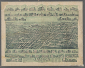
Jamaica, Long Island, N.Y
The Long Island City and Newt…
m
Hagstrom's map of Queens N.Y.…
m
Shell street guide of Brookly…
m
New map of Kings and Queens c…
m
Map of Kings and part of Quee…
A plott of ye situations of t…
m
Hammond's standard map of the…
m
New York City map and directo…
Map of Garret Nostrand's farm…
Map of valuable property situ…
m
Map of the Queens Boro[ugh], …
m
Map of the northern part of t…
Map of the northern part of t…
Queens Borough, City of New Y…
m
Library map 1908
m
Map of the village of East Ne…
Handy map of Brooklyn showing…
m
Map of the village of Astoria…
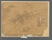
Jamaica
m
Map of the village of Jamaica…
Map of Long Island City, Quee…
Outline and Index Map of the …
m
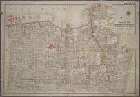
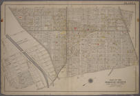
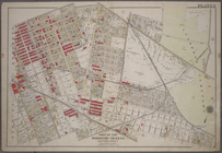
Plate 1: Bounded by (East Riv…
m
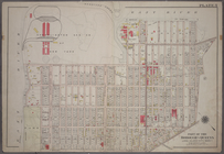
Plate 2: Bounded by (East Riv…
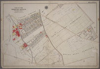
Plate 3:Bounded by (Dutch Kil…
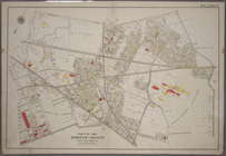
Plate 4: Bounded by Rapelje A…
Plate 5: Bounded by (Con. Ed.…
Plate 6: Bounded by Laurel Hi…
Plate 7: Bounded by Maspeth A…
Plate 8: Bounded by Stanhope …
1
2
Previous
Next
1
2
Previous
Next