Click to visit the main New York Public Library Homepage
The New York Public Library
Digital Collections
About Digital Collections
Browse
Search only public domain materials
Items
Collections
Divisions
Home
Search
Browse
About
Search only public domain materials
Items
Collections
Divisions
Digital Collections
Using Images
Using Data
Search
Filtered keyword search
Show filters
Hide filters
Show Only Public Domain
topic
Colonies
1
Harbors
1
History
1
Nautical charts
1
name
x
Jefferys, Thomas, -1771
Anville, Jean Baptiste Bourguignon d', 1697-1782
1
De Brahm, John Gerar William, 1717-approximately 1799
1
Egmont, John Perceval, Earl of, 1711-1770
1
Fuller, William, active 1769
1
More
Less
collection
Maps of North America
5
Lawrence H. Slaughter Collection of English maps, charts, globes, books and atlases
1
place
North America -- Maps -- Early works to 1800
2
Amelia Island (Fla.)
1
America
1
Boston Harbor (Mass.)
1
Connecticut
1
More
Less
genre
Maps
6
Nautical charts
1
Portolan charts
1
Prints
1
publisher
T. Jefferys?
2
Printed for Robt. Sayer ... and T. Jefferys
1
Published by Thomas Jefferys, geographer to the King in the Strand
1
Thomas Jefferys
1
Thos. Jefferys
1
division
Map Division
6
type
x
cartographic
Date Range
to
6 results found for:
x
Cartouches
Filtering on:
x
Name
: Jefferys, Thomas, -1771
x
Type
: cartographic
Sort by:
Relevance
Title
Date created
Date digitized
Sequence
North America
note:
…' name under
cartouche
.
North America
note:
…' name within
cartouche
.
Plan of Amelia Island in East…
note:
…. Fuller."--
Cartouche
.
m
The provinces of New York, an…
note:
… and
cartouche
: According
North America from the French…
abstract:
… decorative
cartouche
m
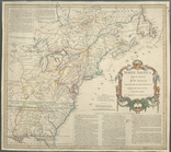
A map of the most inhabited p…
abstract:
….
Cartouche
at lower right