Click to visit the main New York Public Library Homepage
The New York Public Library
Digital Collections
About Digital Collections
Browse
Search only public domain materials
Items
Collections
Divisions
Home
Search
Browse
About
Search only public domain materials
Items
Collections
Divisions
Digital Collections
Using Images
Using Data
Search
Filtered keyword search
Show filters
Hide filters
Show Only Public Domain
topic
Blacks
1
Cod fisheries
1
History
1
Missions
1
West Indies, British
1
name
x
Moll, Herman, -1732
Church of England
1
Humphreys, David, 1689-1740
1
Keith, William, Sir, 1680-1749
1
Senex, John, -1740
1
More
Less
collection
Lawrence H. Slaughter Collection of English maps, charts, globes, books and atlases
2
place
Middle Atlantic States -- Maps -- Early works to 1800
1
New England
1
New England -- Maps -- Early works to 1800
1
New Jersey
1
New York (N.Y.)
1
More
Less
genre
Maps
2
publisher
Printed at the expence of the Society for the encouragement of learning, by S. Richardson ..
1
Printed by Joseph Downing
1
Printed by Joseph Downing,
1
division
Map Division
2
type
x
cartographic
Date Range
to
2 results found for:
x
Account books
Filtering on:
x
Name
: Moll, Herman, -1732
x
Type
: cartographic
Sort by:
Relevance
Title
Date created
Date digitized
Sequence
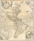
A map of New England, New Yor…
collection:
An historical
account
A new and correct map of Amer…
collection:
…. With a chronological
account