Click to visit the main New York Public Library Homepage
The New York Public Library
Digital Collections
About Digital Collections
Browse
Search only public domain materials
Items
Collections
Divisions
Home
Search
Browse
About
Search only public domain materials
Items
Collections
Divisions
Digital Collections
Using Images
Using Data
Search
Filtered search
Show filters
Hide filters
Show Only Public Domain
topic
Administrative and political divisions
2
History
1
Long Island, Battle of, New York, N.Y., 1776
1
Nautical charts
1
name
x
Holland, Samuel, 1728-1801
Pownall, Thomas, 1722-1805
2
Broenner, Harry Lodowick
1
Contger, Henry
1
Des Barres, Joseph F. W. (Joseph Frederick Wallet), 1729-1824
1
More
Less
collection
x
Lawrence H. Slaughter Collection of English maps, charts, globes, books and atlases
place
New York (State)
4
New Jersey
2
Northeastern States
2
Québec (Province)
2
Early works to 1800
1
More
Less
genre
Maps
5
publisher
J.F.W. Des Barres, Esqr.,
1
Printed for Robt. Sayer & John Bennett ..
1
Printed for Robt. Sayer ... and T. Jefferys
1
Printed for Robt. Sayer and Jno. Bennett
1
Published by Harry Lodowick Broenner ..
1
division
Map Division
5
type
cartographic
5
Date Range
to
5 results found
Filtering on:
x
Name
: Holland, Samuel, 1728-1801
x
Collection
: Lawrence H. Slaughter Collection of English maps, charts, globes, books and atlases
For more collection details, visit the
Lawrence H. Slaughter Collection of English maps, charts, globes, books and atlases collection page
.
Sort by:
Title
Date created
Date digitized
Sequence
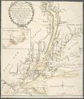
A plan of Fort Montgomery & F…
The provinces of New York, an…
The provinces of New York, an…
m
The provinces of New York, an…
The seat of action between th…