Click to visit the main New York Public Library Homepage
The New York Public Library
Digital Collections
About Digital Collections
Browse
Search only public domain materials
Items
Collections
Divisions
Home
Search
Browse
About
Search only public domain materials
Items
Collections
Divisions
Digital Collections
Using Images
Using Data
Search
Filtered search
Show filters
Hide filters
Show Only Public Domain
topic
x
Nautical charts
Description and travel
2
Harbors
1
History
1
name
x
Jefferys, Thomas, -1771
De Brahm, John Gerar William, 1717-approximately 1799
1
Egmont, John Perceval, Earl of, 1711-1770
1
Fuller, William, active 1769
1
collection
Atlases, gazetteers, guidebooks and other books
2
Maps of North America
1
place
West Indies
2
Amelia Island (Fla.)
1
East Florida
1
Florida
1
Nassau River (Fla.)
1
More
Less
genre
Maps
2
Frontispieces
1
Illustrations
1
Nautical charts
1
Portolan charts
1
More
Less
publisher
R. Sayer and J. Bennett
2
Published by Thomas Jefferys, geographer to the King in the Strand
1
division
Map Division
3
type
cartographic
2
still image
1
Date Range
to
3 results found
Filtering on:
x
Name
: Jefferys, Thomas, -1771
x
Topic
: Nautical charts
Sort by:
Title
Date created
Date digitized
Sequence
Plan of Amelia Island in East…
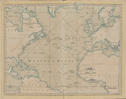
The Atlantic or Western Ocean
The West-India atlas..., [Fro…