Click to visit the main New York Public Library Homepage
The New York Public Library
Digital Collections
About Digital Collections
Browse
Search only public domain materials
Items
Collections
Divisions
Home
Search
Browse
About
Search only public domain materials
Items
Collections
Divisions
Digital Collections
Using Images
Using Data
Search
Filtered search
Show filters
Hide filters
Show Only Public Domain
topic
History
5
Nautical charts
3
Description and travel
2
Harbors
2
Indians of North America
2
More
Less
name
x
Jefferys, Thomas, -1771
Sayer, Robert, 1725-1794
8
Fry, Joshua, approximately 1700-1754
6
Jefferson, Peter, 1708-1757
6
Canot, Pierre Charles, 1710-1777
5
More
Less
collection
Maps of North America
16
I. N. Phelps Stokes Collection of American Historical Prints
7
Lawrence H. Slaughter Collection of English maps, charts, globes, books and atlases
5
Atlases, gazetteers, guidebooks and other books
2
Maps of New York City and State
2
More
Less
place
Maryland
4
Maryland -- Maps -- Early works to 1800
4
Middle Atlantic States -- Maps -- Early works to 1800
4
Virginia
4
Virginia -- Maps -- Early works to 1800
4
More
Less
genre
Maps
24
Prints
11
Views
3
Aerial views
1
Frontispieces
1
More
Less
publisher
John Bowles
3
T. Jefferys
3
Printed for Robt. Sayer at No. 53 in Fleet Street, & Thos. Jefferys at the corner of St. Martins Lane, Charing Cross
2
Printed for Robt. Sayer at No. 53 in Fleet Street, & Thos. Jefferys at the corner of St. Martins Lane, Charing Cross,
2
R. Sayer and J. Bennett
2
More
Less
division
Map Division
25
Wallach Division: Print Collection
8
type
cartographic
24
still image
10
Date Range
to
34 results found
Filtering on:
x
Name
: Jefferys, Thomas, -1771
Sort by:
Title
Date created
Date digitized
Sequence
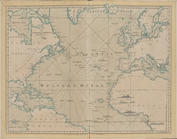
The Atlantic or Western Ocean
The West-India atlas..., [Fro…
The stocking-frame and other …
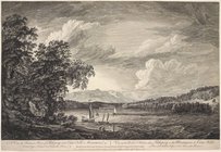
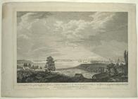
A view in Hudson's River of P…
A view of Louisbourg in North…
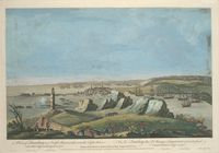
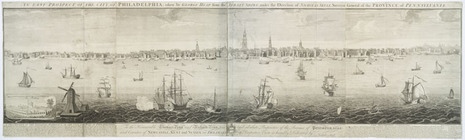
An east prospect of the city …
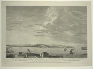
A view of the city of Boston …
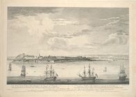
A view of the city of Quebec,…
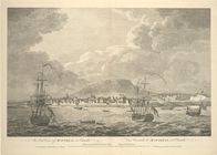
An east view of Montreal, in …
[A south east view of the cit…
A south west view of the city…
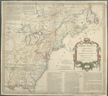
A general map of the middle B…
m
A map of the most inhabited p…
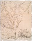
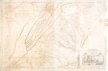
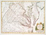
A map of Virginia and Maryland
North America
North America
A general map of the middle B…
m
The provinces of New York, an…
North America from the French…
A map of the most inhabited p…
m
A map of the most inhabited p…
A map of the most inhabited p…
A map of the most inhabited p…
A prospective view of the bat…
m
A map of the most inhabited p…
m
A map of the most inhabited p…
A prospective view of the bat…
Plan of the town and harbour …
A plan of Bahia del Espiritu …
East Florida : from surveys m…
m
A map of South Carolina and a…
A plan of the attack of Fort …
Plan of Amelia Island in East…
m
A map of the most inhabited p…
End of results
|
Top