Click to visit the main New York Public Library Homepage
The New York Public Library
Digital Collections
About Digital Collections
Browse
Search only public domain materials
Items
Collections
Divisions
Home
Search
Browse
About
Search only public domain materials
Items
Collections
Divisions
Digital Collections
Using Images
Using Data
Search
Filtered search
Show filters
Hide filters
Show Only Public Domain
topic
Administrative and political divisions
13
Railroads
9
Counties
7
Roads
4
Indian reservations
2
More
Less
name
x
Johnson, A. J. (Alvin Jewett), 1827-1884
collection
Maps of North America
17
Maps of New York City and State
1
place
United States
4
Connecticut
2
Dakota Territory
2
Idaho
2
Massachusetts
2
More
Less
genre
Maps
18
Illustrations
1
publisher
x
A.J. Johnson
division
Map Division
18
type
cartographic
18
still image
1
Date Range
to
18 results found
Filtering on:
x
Name
: Johnson, A. J. (Alvin Jewett), 1827-1884
x
Publisher
: A.J. Johnson
Sort by:
Title
Date created
Date digitized
Sequence
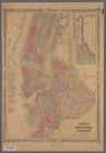
Johnson's New York and Brookl…
Johnson's Arkansas, Mississip…
Johnson's California, also Ut…
Johnson's Maine
Johnson's Massachusetts, Conn…
Johnson's Vermont, New Hampsh…
Johnson's United States
Johnson's Kentucky and Tennes…
Johnson's Virginia, Delaware,…
Johnson's North Carolina and …
Johnson's Georgia and Alabama
Johnson's Ohio
Johnson's Nebraska, Dakota, I…
Johnson's Vermont and New Ham…
Johnson's Nebraska, Dakota, I…
Johnson's Minnesota
Johnson's Minnesota
Johnson's Indiana
End of results
|
Top