Click to visit the main New York Public Library Homepage
The New York Public Library
Digital Collections
About Digital Collections
Browse
Search only public domain materials
Items
Collections
Divisions
Home
Search
Browse
About
Search only public domain materials
Items
Collections
Divisions
Digital Collections
Using Images
Using Data
Search
Filtered search
Show filters
Hide filters
Show Only Public Domain
topic
Nautical charts
4
Colonies
1
Commedia dell'arte
1
Couples
1
Harlequin (Fictitious character)
1
More
Less
name
x
Laurie & Whittle
Holland, N., Captain
3
Fisher, Joshua, 1707-1783
1
Fry, Joshua, approximately 1700-1754
1
Jefferson, Peter, 1708-1757
1
More
Less
collection
Lawrence H. Slaughter Collection of English maps, charts, globes, books and atlases
6
Maps of North America
5
John H. Levine Collection
1
Maps of Europe
1
Prints depicting dance
1
More
Less
place
Maps
4
Canada -- Maps -- Early works to 1800
3
America
2
Atlantic Coast (U.S.)
2
Early works to 1800
2
More
Less
genre
Maps
13
Prints
2
publisher
Laurie & Whittle
3
Publish'd by Laurie & Whittle, 53 Fleet Street
3
Published by Laurie & Whittle, No. 53 Fleet Street,
2
Rob[er]t Laurie & James Whittle, No. 53 Fleet Street
2
Laurie and Whittle
1
More
Less
division
Map Division
13
George Arents Collection
1
Jerome Robbins Dance Division
1
type
cartographic
13
still image
2
text
1
Date Range
to
15 results found
Filtering on:
x
Name
: Laurie & Whittle
Sort by:
Title
Date created
Date digitized
Sequence
A chart of Delaware Bay and R…
m
A map of the most inhabited p…
A map of the most inhabited p…
A new and accurate chart (fro…
A new and accurate chart (fro…
A New and correct map of the …
A New and correct map of the …
A New and correct map of the …
A new and general map of the …
A new chart of the coast of N…
A new map of North America wi…
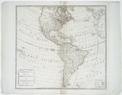
America divided into North an…
m
Harlequin and Mother Goose: o…
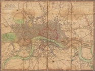
Laurie and Whittle's New map …
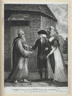
Sterne exchanging his snuff b…
End of results
|
Top