Click to visit the main New York Public Library Homepage
The New York Public Library
Digital Collections
About Digital Collections
Browse
Search only public domain materials
Items
Collections
Divisions
Home
Search
Browse
About
Search only public domain materials
Items
Collections
Divisions
Digital Collections
Using Images
Using Data
Search
Filtered search
Show filters
Hide filters
Show Only Public Domain
topic
Railroads
4
Triangulation
4
Surveying
3
Canals
2
Land grants
2
More
Less
name
x
Weed, Parsons & Co
Colvin, Verplanck, 1847-1920
5
New York (State). Adirondack Survey
5
Andrews, Horace
3
Gardiner, James T. (James Terry), 1842-1912
3
More
Less
collection
Maps of New York City and State
13
Four thousand miles of African travel: a personal record of a journey up the Nile and through the Soudan to the confines of Central Africa, embracing a discussion on the sources of the Nile, and an examination of the slave trade
1
Maps of North America
1
place
New York (State)
9
Adirondack Mountains (N.Y.)
6
Hudson River (N.Y. and N.J.)
3
Pennsylvania
2
Africa
1
More
Less
genre
Maps
14
Surveys
2
Prints
1
land surveys
1
publisher
Adirondack survey
3
Lith. by Weed, Parsons, & Co
3
New York State Survey
3
Adirondack Survey
2
publisher not identified
2
More
Less
division
Map Division
14
Schomburg Jean Blackwell Hutson Research and Reference Division
1
type
x
cartographic
Date Range
to
15 results found
Filtering on:
x
Name
: Weed, Parsons & Co.
x
Type
: cartographic
Sort by:
Title
Date created
Date digitized
Sequence
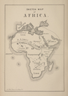
Sketch map of Africa
Noua Terrae-Mariae tabula
Map showing the rail roads wi…
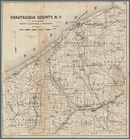
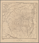
Map of Chautauqua County, N.Y…
m
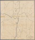
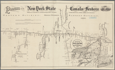
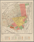
The New York wilderness: Hami…
m
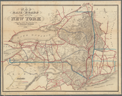
Map of the rail-roads of the …
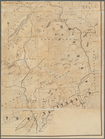
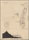
Adirondack survey, 1873: Bald…
Profiles of the New York Stat…
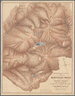
Sketch showing contour lines …
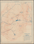
Adirondack survey, sketch sho…
Adirondack survey, Sketch in …
Adirondack Survey, 1873, seco…
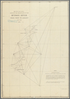
Sketch of the triangulation o…
Sketch of the triangulation o…
Sketch of the triangulation o…
End of results
|
Top