Click to visit the main New York Public Library Homepage
The New York Public Library
Digital Collections
About Digital Collections
Browse
Search only public domain materials
Items
Collections
Divisions
Home
Search
Browse
About
Search only public domain materials
Items
Collections
Divisions
Digital Collections
Using Images
Using Data
Search
Filtered search
Show filters
Hide filters
Show Only Public Domain
topic
Real property
555
Description and travel
87
Landowners
86
Railroads
73
Fire insurance
71
More
Less
name
Beers, F. W. (Frederick W.)
229
Everts, Ensign & Everts
137
Fairchild Aerial Camera Corporation
126
New York (N.Y.). Bureau of Engineering
126
Tuttle, Arthur S. (Arthur Smith), 1865-1949
126
More
Less
collection
Atlases of the United States
441
Atlases of New York City
336
Maps of New York City and State
183
Maps of North America
133
Collection of broadside real estate maps announcing auctions of lots in early 19th century New York City
3
More
Less
place
New York (State)
604
New York (N.Y.)
153
Westchester County (N.Y.)
88
Genesee County (N.Y.)
84
Long Island (N.Y.)
84
More
Less
genre
Maps
1043
Atlases
430
Cadastral maps
98
Prints
63
Manuscript maps
18
More
Less
publisher
Beers, Comstock & Cline
83
Sanborn Map Company
70
Everts, Ensign & Everts
53
F. W. Beers & Co
51
F. W. Beers, A. D. Ellis & others
38
More
Less
division
Map Division
1097
Rare Book Division
4
Manuscripts and Archives Division
2
General Research Division
1
Schomburg Jean Blackwell Hutson Research and Reference Division
1
type
x
cartographic
text
19
still image
15
Date Range
to
1,105 results found
Filtering on:
x
Note
: "Amer. Book Co. NY photo header 4086."--written on border.
x
Type
: cartographic
Sort by:
Title
Date created
Date digitized
Sequence
m
Map of the Cedar Knolls, at B…
Residence of James Carrigan, …
The Cord Meyer Development Co…
Rand, McNally & Co.'s new aut…
m
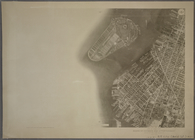
Flushing Bay, Long Island, N.…
m
Rand, McNally & Co.'s complet…
Hollis Terrace addition no. 1…
Rand, McNally & Co.'s new han…
Rand McNally & Co.'s new hand…
Property in the towns of Cast…
m
Map of the borough of Brookly…
m
Robinson's map of New York Ci…
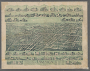
Jamaica, Long Island, N.Y
m
Rand McNally & Co.'s road map…
Map of portion of greater New…
m
Map of the southern part of W…
Map shewing the location of t…
Pennsylvania - Paoli, Chester…
m
Rand, McNally & Co.'s Minneso…
Rand, McNally & Co.'s Illinoi…
Rand, McNally & Co.'s New Jer…
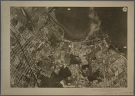
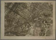
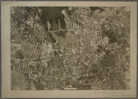
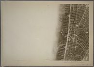
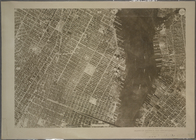
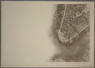
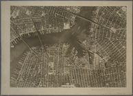
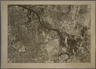
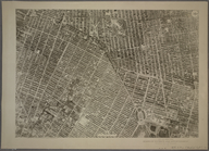
9B - N.Y. City (Aerial Set).
9C - N.Y. City (Aerial Set).
9D - N.Y. City (Aerial Set).
10A - N.Y. City (Aerial Set).
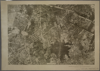
10B - N.Y. City (Aerial Set).
10C - N.Y. City (Aerial Set).
10D - N.Y. City (Aerial Set).
11A - N.Y. City (Aerial Set).
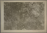
11B - N.Y. City (Aerial Set).
11C - N.Y. City (Aerial Set).
11D - N.Y. City (Aerial Set).
12A - N.Y. City (Aerial Set).
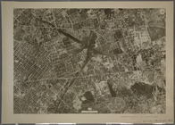
12B - N.Y. City (Aerial Set).
12C - N.Y. City (Aerial Set).
12D - N.Y. City (Aerial Set).
13A - N.Y. City (Aerial Set).
13B - N.Y. City (Aerial Set).
13C - N.Y. City (Aerial Set).
13D - N.Y. City (Aerial Set).
14A - N.Y. City (Aerial Set).
14B - N.Y. City (Aerial Set).
14C - N.Y. City (Aerial Set).
14D - N.Y. City (Aerial Set).
15A - N.Y. City (Aerial Set).
15B - N.Y. City (Aerial Set).
15C - N.Y. City (Aerial Set).
15D - N.Y. City (Aerial Set).
16A - N.Y. City (Aerial Set).
16B - N.Y. City (Aerial Set).
1
2
3
4
5
Previous
Next
1
2
3
4
5
Previous
Next