Click to visit the main New York Public Library Homepage
The New York Public Library
Digital Collections
About Digital Collections
Browse
Search only public domain materials
Items
Collections
Divisions
Home
Search
Browse
About
Search only public domain materials
Items
Collections
Divisions
Digital Collections
Using Images
Using Data
Search
Filtered search
Show filters
Hide filters
Show Only Public Domain
topic
Real property
1417
Fire insurance
733
Cities & towns
730
History
16
Landowners
16
More
Less
name
Sanborn Map Company
734
G.W. Bromley & Co
503
Bromley, George Washington
235
Bromley, Walter Scott
235
Robinson, E. (Elisha)
90
More
Less
collection
Atlases of New York City
1401
Atlases of the United States
163
Maps of North America
41
Maps of New York City and State
32
Collection of broadside real estate maps announcing auctions of lots in early 19th century New York City
9
More
Less
place
New York (State)
1459
New York
612
Manhattan (New York, N.Y.)
460
New York (N.Y.)
187
Brooklyn (New York, N.Y.)
65
More
Less
genre
Maps
1643
Atlases
163
Cadastral maps
26
Prints
26
Manuscript maps
4
More
Less
publisher
Sanborn Map Company
732
G.W. Bromley & Co
474
E. Robinson Co
82
E. Belcher Hyde
34
G.W. Bromley
28
More
Less
division
Map Division
1648
Manuscripts and Archives Division
5
Wallach Division: Print Collection
4
General Research Division
3
Milstein Division
3
More
Less
type
x
cartographic
still image
7
text
7
Date Range
to
1,667 results found
Filtering on:
x
Note
: "J W"--initials in block, bottom right.
x
Type
: cartographic
Sort by:
Title
Date created
Date digitized
Sequence
m
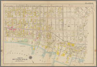
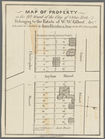
Maps of property in the city …
Map of Camp Chase. Drawn on a…
Atlas of the Oranges embracin…
Map of Newtown, Long Island :…
General views, W, 39th St.
Harrison's map of Jersey City…
m
Map of property at Fairmount…
Map showing route of marches …
Bounded by Avenue D., Ralph A…
Bounded by Avenue J., E. 56th…
Bounded by Avenue P., E. 31st…
Bounded by Avenue V., Knapp S…
Coney Island. Bounded by Cana…
Bounded by Bay View Avenue, W…
Bounded by Ocean Parkway, Ave…
Bounded by (Vanderveer Park) …
Bounded by 86th Street, W. 9t…
Bounded by 86th Street, W. 11…
Bounded by 72nd Street, 22nd …
Bounded by 58th Street, West …
Subdivision of Block 5 of the…
m
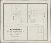
Map of lots to be sold at auc…
Map of lots to be sold at auc…
Executors sale of part of the…
m
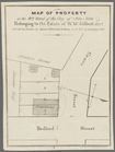
Map of property in the 9th wa…
m
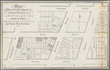
Map of part of the real estat…
m
Map of property in the 9th wa…
m
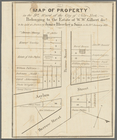
Map of property in the 9th wa…
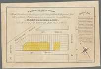
By order of the Court of Chan…
Map of lots to be sold at pub…
General map to accompany the …
Eagle Harbor Copper Co, and E…
J.L. Hill Printing Co.'s map …
m
Map of the vicinity of Philad…
J.H. Colton's topographical m…
Chart of the N.W. coast of Am…
Carte du Soudan Occidental dr…
Whitesboro, Brown Co., W.T.
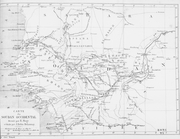
Map of explorations in north …
m
Tivoli calculation for Peter …
m
Division line between W. N. a…
m
Evaluation of W. Blaau's esta…
m
Mr. Maxwell's store and J. De…
C.W. Hobbs' traveler's guide …
Map showing route of marches …
m
Highwood Park, East of Glenwo…
m
Auction sale at Montrose Stat…
m
Map of the city of Newark, N.…
m
Guide map of the city of Eliz…
m
Map of Jersey City and Hoboke…
1
2
3
4
5
6
7
Previous
Next
1
2
3
4
5
6
7
Previous
Next